Gary woke us again at 0700, but I stayed in bed until 0725 when Dr Ann came in to check I was OK & not sea-sick or something.
At that point I decided I'd better get up!
I'd left conditioner on my hair overnight, so I quickly rinsed it off, dressed & went downstairs to the dining room. There were only 15 peeps having food - meaning over 1/2 of the passengers were missing breakfast.
Afterwards I went up top for my first view of Bjørnøya.
 |
| It's out there in the mist, somewhere |
Because Bear Island lies on a boundary between cold water of polar origin and warmer Atlantic water, water temperatures within a few dozen nautical miles of the island are quite variable, sometimes reaching 10 °C (50 °F) in summer. The polar night lasts from 8 November until 3 February, and the period of midnight sun from 2 May until 11 August. With just 595 hours of bright sunshine per year, Bear Island has the lowest average yearly sunshine in Europe.[10]
The island has a club for nude dippers ("Bjørnøya nakenbadeforening"), with over 3,000 members.[8]
Despite its name, Bear Island is not a permanent residence of polar bears, although many arrive with the expanding pack ice in the winter. Occasionally, a bear will stay behind when the ice retreats in spring and remain through the summer months.[11] Moreover, the sub-population of Ursus maritimus polar bears found here is a genetically distinct set of polar bears associated with the Barents Sea region.
The bit about skinny-dippers is fun, but I guess they don't all turn up at once ;-p
 |
| Genus unknown, but it's in focus & nearly in the middle ~ a nice change from most of my bird pics! |
It was pretty misty/cloudy, & the sea was fairly rough.
I didn't mind, tho. I have good sea-legs, & spent a while after breakfast clicking away.
 |
| This looks like a skua? |
 |
| Not a clue, but the tail looks like it could belong to a Great Skua. Now I sound like a Twitcher ;-p |
 |
| Jay's book about Amundsen |
I nipped back downstairs at some point & took a quick pic of the cover of Jay's Amundsen book.
As I planned to give it away, I thought I should record it for posterity.
I'd read the PP copy of it, & thought it was very interesting.
 |
| Bear Island cliffs appear out of the mist . . . |
 |
| but we're still a way off yet |
 |
| Nearly there |
 |
| One of the crew gets ready on the gangway |

I googled Sørhamma, but couldn't find it. However, the Puffin Post indicated it was on the southern tip of the triangular island, & a blog I read while trying to find out had it spelt as Sørhamna. The map below shows it as a 1/2 moon bay at about 5 o'clock.
As it happens, I must've been on the ball as my notes spell it correctly.

While we approached, most peeps were in the dry indoors!
 |
| Transfixed & dry on the bridge |
 |
| We get ready for a wet ride on a zodiac |
At about half past eight, we had the call to gather on the fore-deck & get ready to board the zodiacs.
Given the weather, I was glad I had my ski-pants as wets. At least I'd be dry and warm.
 |
| Loading the first zodiac |
 |
| Heidi at the helm in a fetching hat ;-) |
I was on Heidi's zodiac, & as you can see, we were all bundled up!
 |
| Sheer cliffs |
 |
| & sea caves |
At this point, I'm going to shut up for a bit & let the pictures tell the story.
It was am amazing morning, if a very wet one ~ bucking & rolling over the waves!
 |
| The water was a great colour, despite the grey sky |
 |
| Big seas = wet peeps! |
 |
| Impressive coastline . . . |
 |
| turquoise sea . . . |
 |
| & colourful cliffs |
 |
| Check out the green, oranges & purples above the turquoise |
 |
| Ditto |
 |
| A cute beach, but not the weather for a swim |
 |
| All sorts of animals in the rock formations . . . |
 |
| Depending on which way you turn your head |
 |
| The colours were amazing . . . |
 |
| & the holes & caves pretty cool, too |
 |
| I wonder what made the water this colour in this weather! |
 |
| Heidi |
 |
| Still amazing colours |
 |
| A tiny rocky beach into a sea cave |
 |
| Birds on a ledge of rock |
 |
| I wonder if they join up? |
 |
| The sea seemed calmer under these cliffs |
 |
| But as we turned the corner the swell got bigger . . . |
 |
| & we got wetter |
 |
| You can see how low the cloud was on this one |
 |
| It looks like it was sunny, but it wasn't |
 |
| Headed cave-wards |
 |
| Yet more caves |
 |
| You can just see the bottom edge of the sea-mist |
 |
| Stacks of stacks |
 |
| A phallic stack |
 |
| One of the waterfalls fed by one of the 600 (or so) small lakes on the plateau |
 |
| The Petrozavodsk wreck aground under the cliffs |
The Petrozavodsk

There are several versions of the tale of this wreck. The one in the Puffin Post said the crew became 3 sheets to the wind after the wreck because they thought they were going to die. Other stuff variously says the Mate on watch fell asleep; the Captain was drunk; the crew was drunk. All of which brings to mind the English sea shanty/nursery rhyme "What Shall We Do With The Drunken Sailor?"
What shall we do with the drunken sailor,
What shall we do with the drunken sailor,
What shall we do with the drunken sailor,
Earl-aye in the morning?
Chorus:
Way hay up she rises
Way hay up she rises
Way hay up she rises
Earl-aye in the morning
Traditional verses:
1. Put him in the long boat till he's sober,
2. Put him in the scuppers with a hose-pipe on him.
3. Shave his belly with a rusty razor.
4. Put him in the brig with the captain's daughter.
Note the reference to The Captain's Daughter means the Cat O' Nine Tails, & not a nice young lady!
Try & find this on Google & play it. It's great fun, even though they don't do all the verses :-))Drunken Sailor - YouTube
https://www.youtube.com/watch?v=7OGXaZDyce8
24 May 2012 - Uploaded by oldmacdonaldrhymes
Drunken sailor - What Shall We Do With the Drunken Sailor Sung by PaulAustin Kelly and Richard Durrant ...But now back to more serious stuff:
My notes say we went round Kapp Koltlhoff & past the Stappen Rocks on the way back to the PP, & "Very choppy & big swell = V Wet"
There were loads of birds of various kinds to see, & we got a running commentary from Heidi before heading PP-wards after about an hour & a half.
 |
| Guillimots?? |
 |
| At this point (1030 approx), we'd been sitting in the zodiac for >an hour & were Very wet. |
The impression from this pic is that we were all ready to get back aboard into the warm & dry!
 |
| On the lookout for cetaceans |
And it wasn't long before many of us were up on the bridge waiting for lunch.
Knowing we were to go walkies after lunch, I'd put my salopettes & gloves in the sauna to dry before heading for some chicken gumbo - I had 4 pieces!
 |
| Chart showing our position to the west, & a few of the many lakes on the top of the plateau |
 |
| We were headed for landfall in the north |
My notes say the PP went south a little from Sørhamma, & up the west coast to Lunckevika, Keilhavoya Rock & Honvika Bay, but Google wasn't helpful on this occasion :-(
We were due to arrive about 1330, so I changed into my (now dry) salopettes.
When we arrived, Gary called us on deck for our 2nd Bjørnøya adventure, so off we trotted, turning our tags to say we were no longer on board.
 |
| Boarding the zodiacs at 1/4 to one |
 |
| 3 of the crew members |
 |
| We beach on Bjørnøya |
 |
| Aurora staff tooled up in case of bears! |
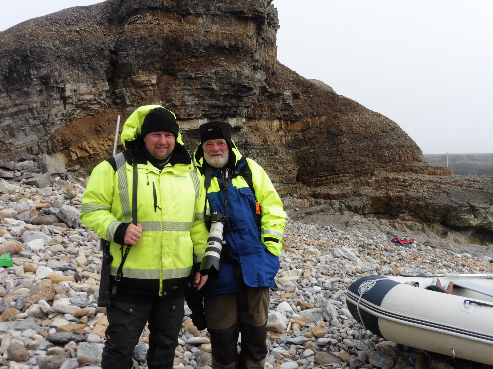 |
| 2 blokes whose sloop was moored in the bay |
 |
| Heidi had told us about the flora on the island. Apparently, tundra trees are only a few inches tall. I think these flowers are Purple Saxifrage? |
 |
| According to the Expedition book, this is Tufted Saxifrage |
Each of the Aurora staff had a rifle, & I recall Gary telling us that polar bears move deceptively quickly, even when they're just walking.
 |
| Flowers on the slope |
As we all gathered on the beach we were reminded to keep our eyes open, stay aware, & stay together.
 |
| The white dome of a weather station building?? |
There was a steep slope to negotiate to get up from the beach onto the plateau, & I remember hauling one of my fellow passengers up a particularly steep bit. Not positive, but it may have been Roberta from Florida? She wasn't the only one who struggled on occasion: quite a few of PP's guests were older than me, & many weren't very fit :-/
We walked for about an hour towards some buildings.
They appeared deserted, but I think they were part of the meteorological station run by the Norwegian government?
 |
| Looking west (Um??) from Bjørnøya's cliffs |
 |
| If this was the west coast, Greenland is about 1000k across the sea |
On the way back to the beach I saw an Arctic Willow.
However, it wasn't very interesting to look at, so no photo.
As Heidi had explained, they only grow a few inches high due to the ever present wind, & the fact that it is virtually impossible to put proper tree roots down through the permafrost.
 |
| A desolate pavement |
I also noticed the tundra pavement we'd been told about in a lecture, so I took a pic.
I couldn't recall what we'd been told about the patterns on the tundra, so I googled it:
Ice wedges grow as the ice-rich frozen ground contracts during the winter and forms open cracks below the surface. As the ground surface warms and the snow thaws in the spring, meltwater flows into the open cracks and freezes. But the ground beneath is still frozen, and as the freezing water expands, it forces the surrounding soil upward and outward. This process creates the ridges and troughs typically seen on either side of the ice wedges. Networks of ice wedges form the distinctive polygonal patterns that mark the surface of permafrost. These features, commonly found in areas of both permafrost and seasonal frost, are formed by contraction cracks enlarged by ice wedges.
For any form of publication, please include the link to this page: www.grida.no/resources/3953
The page has some nice pics as well, but all from Greenland, so not relevant here.
 |
| More Tufted Saxifrage |
Back at the slope above the beach I got a few more pics of the Bjørnøya flora.
 |
| A green & moss-like mound of ??? |
 |
| This may be Saxifrage as well? Pink? |
 |
| Colours amidst the rocks |
 |
| One of these belonged to those blokes I met earlier |
I also got a shot of the bay & 2 anchored sloops.
They weren't very big, so
I guess their Captains must've been experienced sailors to be this far north, & such a long sail away from most other places.
We were back on the PP before 4, so once I'd changed it was time for carrot cake & hot chocolate with Diane, Ellie (AKA Dobby) & Tony.
I also went back in the sauna & then fell asleep in bed afterwards, waking with a cold sore :-(
Dr Ann gave me some anti-viral pills which I took with a mouthful of red at dinner! I realise it may not be a good idea, but the water had ice in it & I'd been cold enough for one day!
My notes say I sat with Don & Irene, Stephen, Ola the Norwegian Pilot, & Tony, Dobby & Diane.
I remember I ate quite a lot of pork ;-q
 |
| On board after 2200, the sun tries to shine |
 |
| Taken at 2214 & the sun's still higher than the yardarm! |
 |
| Diane & Tony have a chinwag |
The day ended with a short stint on the bridge, before bed & sudoku at 2320.
So ended my day on Bear Island, & not a Mormont in sight ;-p
OAO