July 8th: Getting to Oban, & out to Tobermory
Northern had a strike & cancelled the 0811 from Blackpool North, so I got up at 0620, did Opal & got a taxi to the station (it was raining) for the 0740. I had a bit of a wait for the 0837 to Glasgow, & when it came I found my reserved seat was next to someone who badly needed a wash - I was nearly heaving with the smell :-(
I'd packed muesli w yoghurt & a few kiwi, so that was breakfast, but I moved away from The Smell before I ate breakfast!
I texted JohnB on the train - he'd been watching the final game of the 2017 Lions Tour (it was in NZ) & he said it ended 15 all. So, the series was a draw.
In Glasgow I had over an hour to wait before my train up to Oban from Queen St, so I went to the cafe I'd used before & where I knew I'd be able to get online. It's the Olive Tree on Buchanan St.
At Queen St, the train was in two halves & the front bit went to Fort William. Therefore I got in the back bit or I'd miss the boat. Literally ;-p It split at Tyndrum & while we travelled lochside I ate my packed lunch: chicken, tomatoes & radish. Kilchurn castle looked great in the sunshine :-) But no pic from the train this time.
 At Oban I walked to the pier to find only Pete (the chef) aboard, so dumped the ruckie & had a wander.
A bit later I returned to find everyone else aboard (pic taken by someone who kindly sent it afterwards), & we did the introduction bit. Nikky was Skip, Pete the chef (her partner), Owain from Raglan (on a working holiday) & Ceira from Ireland were deck crew, Katrina from Denmark was Bosun, & Lukas from Poland was 1st Mate. I managed to remember some names when I did my notes that evening & they say I also met Simon below, & David who was in the bunk below me. David is to my right in the pic & my bunk is above mt right ear. I'm in green & either writing up my notes or doing sudoku. Again, someone sent me this & it was taken at some point in the 10 days, but may as well go here as anywhere.
 Nikki asked if anyone wanted to sail off & I got picked. The helm was in a weird place & you had to sit on a big box-thing or stand to one side. I chose to sit & Nikki said Bessie-Ellen took a while to respond & told me to keep my eye on a lighthouse in the distance.
We were headed for Tobermory on Mull, & while I was sat at the wheel everyone else had training on what to do with the foresails & various aspects of ship safety.
When I came off the tiller at the Eilean Musdile lighthouse I got trained as well.
Once we got to Tobermory we had dinner - cooked by Pete. There was garlic mussels (loads & loads ;-q ) with fresh rolls & butter, & salmon, new potatoes & broccoli, & lemon mouse to finish. Douro was involed at some point as well.
After dinner there was general chat - we were anchored in the bay, & I was 1st to bed before 10. Unfortunately I had to climb down 4x during night night for the loo, but David was deaf & didn't wear his hearings aids when in bed.
Nikki asked if anyone wanted to sail off & I got picked. The helm was in a weird place & you had to sit on a big box-thing or stand to one side. I chose to sit & Nikki said Bessie-Ellen took a while to respond & told me to keep my eye on a lighthouse in the distance.
We were headed for Tobermory on Mull, & while I was sat at the wheel everyone else had training on what to do with the foresails & various aspects of ship safety.
When I came off the tiller at the Eilean Musdile lighthouse I got trained as well.
Once we got to Tobermory we had dinner - cooked by Pete. There was garlic mussels (loads & loads ;-q ) with fresh rolls & butter, & salmon, new potatoes & broccoli, & lemon mouse to finish. Douro was involed at some point as well.
After dinner there was general chat - we were anchored in the bay, & I was 1st to bed before 10. Unfortunately I had to climb down 4x during night night for the loo, but David was deaf & didn't wear his hearings aids when in bed.
 |
| July 8th: Oban to Tobermory, approx NW along the Sound of Mull |
July 9th: Tobermory, Canna & Sanday, then a long sail out to St Kilda
I woke before 7 & walked about on deck. Simon had already gone over the side for his swim (it was a daily early-morning ritual), & shortly after everyone else turned up dressed & we swabbed the decks. This was the 1st job we all did every morning.
After breakfast (incl, porridge & warm rolls) we took the dinghy to town for a shower. Nikki had said the aft one on board was broken & the fore one wouldn't cope with everyone.
At the Tobermory marina showers (£2 a go) I did a bit of fettling with the hair so I wouldn't have to argue with knotted locks all week (ie - Jasmine oil. Cunning Plan ;-p ).
 |
| Murky morning |
Here are the pics from that, slightly soggy, morning:
 |
| Off for a shower |
 |
| Clive was invariably smiling |
 |
| Still water in the harbour |
 |
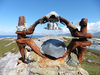
| Significance unknown |
 |
| Tobermory at 10 to 9 |
 |
| On the way back to the boat |
 |
| Smiley Clive on the helm - Captain Nikki keeps an eye out |
 |
| We get ready to sailaway |
Once back aboard we up-anchored & leaving Tobermory & Mull behind we motored out to Canna via the Minch.
 |
| Below looking forward |
I went below for some pics while it was quiet down there.
 |
| Ditto aft |
 |
| Morning coffee & Pete's cake |
 |
| Ceira & Simon knotting |
 |
| Lunch |
 |
| Rabbit, hole, tree, hole etc! |
 |
| David at the wheel, with Chas & Ceira polishing the brass |
 |
| Ardnamurchan |
Once in the Minch, we had Ardnamurchan Point to starboard & saw the famous lighthouse.
Some took turns on the helm & the rest of us kept our eyes out for cetaceans.
We also got training in clove hitches & bowlines. This was a refresher for some of us, but new to others.
Katrina was very patient ~ see pic.
At some point we were asked were we wanted to go after Canna & I said St Kilda because it was on my bucket-list.
Nikki didn't seem too pleased, but as no-one else had a wish-list, the plan was made.
 |
| We went up past the Small Isles from Tobermory to Canna |
 |
| The Rùm & Eigg flat tops |
Muck, Eigg & Rùm
were to starboard on our way up the Minch, & I managed a pic of the 2 bigger ones.
 |
| Aft shower/heads |
 |
| Approaching Canna |
I missed Muck due to looking towards Barra way over in the west.
 |
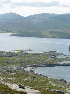
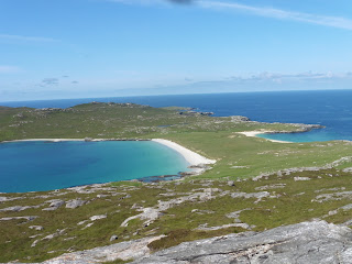
| Anchored in Canna Bay. I don't know what they were looking at |
The Sanday penninsula passed on the port side, & the BE anchored in the deep harbour formed between Canna & Sanday near the 'village' of A'Chill.
There was unlikely to be a loo, so before getting on the zodiac I went to the heads & got a pic while I was at it ;-)
As usual, Wiki provided some info for me:
 |
| Landfall on Sanday |
Canna is the westernmost of the Small Isles archipelago, in the Scottish Inner Hebrides. It is linked to the neighbouring island of Sanday by a road and sandbanks at low tide. The island is 4.3 miles (6.9 km) long and 1 mile (1.6 km) wide. The isolated skerries of Hyskeir and Humla lie 6.2 miles (10.0 km) south west of the island.
Check out Wiki - it has a load of interesting info on the page.
 |
| St Columba's - now deconsecrated |
There was a big church on the hill to the west, so - in shifts, we were all taken to have a look, & some walked on to the Sanday cliffs to
 |
| The BE is just off the point in the bay |
look for puffins.
Detour over I went back to the fork in the track &
 |
| An unusual steeple |
went to the left along the bay for a look at the little church to find it had a great gate amongst other cool things I took pics of.
 |
| Pews & pulpit |
 |
| Through the gate to the harbour |
 |
| The BE & the hill I walked up at the end of her bowsprit |
Turning left out of the gate I walked down to the harbour for a couple more pics ~ laying on the concrete to get arty-farty for the 2nd one, then I walked back to the cafe-cum-shop to await the arrival of the zodiac back to the BE.
 |
| The hill, St Columba's & the BE etc anchored in the bay |
While I waited I had a paddle.
Lukas eventually arrived & I went back with Geoff, but we ran out of gas before we reached the BE & Lukas had to row the last bit.
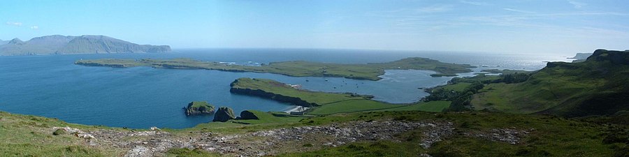 |
Panorama taken from Compass Hill on Canna, overlooking Canna Bay &
Sanday (at high tide), the island of Rùm in the distance. Pic from Wiki |
 |
| The Old Pultney came out for our dinner of H,N &T |
Back aboard it was time for a general chat while the crew got us ready for our journey out to St Kilda.
 |
| The compass, the wheel & the box you sat on at the helm |
 |
| Skye on the horizon while we motor up the Minch |
Pete did haggis, neaps & tatties for dinner while we motored up the Minch.
Various peeps helped to helm while we left Skye to starboard and South Uist, Benbecula and North Uist to port.
Canna is almost level with Eriskay, so I didn't get to see
 |
| South Uist through the rigging |
that lovely island from the sea.
 |
| Ditto. I'd been there in July 2012~see blog |
 |
| A few minutes later |
 |
| Our passage up the Minch, through the Sound of Harris & out west to St Kilda |
 |
| This looks like a lunch?? |
The notes say we had H,N & T, but this pic doen't look like it??
Maybe it's one I was sent & it's in the wrong place?
 |
| West through the Sound of Harris |
Anyway, it gives a decent impression of the food.
The notes also mention chocolate sponge & raspberries & cream, & that I had a Douro instead of the semi-sauv I'd had the night before.
 |
| The 1st pic of the St Kilda archipelago |
Our Watch should have been at 2000 to 0000, but for some reason we ended up doing the 1600 to 2000.
I had a few more mouthfuls of the Gewurtz I had snuck on board in a bottle of elderflower cordial, did a bit of sudoku, & shut my eyes just after 2300.
July 10th: St Kilda, Gannets, & overnight to Taransay
I was woken about 1.5 hours later by banging, so ~ needing the loo anyway, I got up to check it out.
We had arrived in the bay at Hirta and the banging was the Watch doing the anchor, the anchor-ball (up the fore-stay) & getting the BE ready for bed.
 |
| Anchored in Hirta Bay at about 1/2 past midnight . . . |
 |
| & there was still some light in the sky |
 |
| I think this is Soay? |
I eventually woke properly before 7 to more banging, & discovered Sue being ill on deck & Lukas wasn't great either.
 |
| Looking down the other side of Hirta |
I dressed, did some laundry after breakfast - no sign of Pete on his daily dive off the deck?, & hung it out on the gaskets.
I ended up on the last zodiac to shore & got there at 0915.
 |
| More or less the same view, but zoomed |
 |
| The BE et al in the bay from 1/2 way up the Hirta hill |
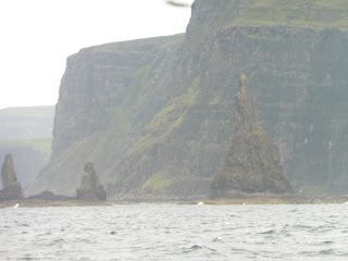
From there I walked through the deserted village, past some weird lumps on the hill - they were hollow inside, & got buzzed by a Bonxie ~ AKA Great Skua: see Shetland blog for pics.
No saint is known as St Kilda, so it's not really known where the name originated, but there are a few theories on Wiki.
Here's some other stuff:
St Kilda
(Gaelic: Hiort) is an isolated archipelago situated 64 kilometres (40 mi) west-northwest of North Uist, in the North Atlantic Ocean. It contains the westernmost islands of the Outer Hebrides of Scotland. The largest island is Hirta, whose sea cliffs are the highest in the United Kingdom. Three other islands (Dùn, Soay and Boreray) were also used for grazing and seabird hunting. The islands are administratively a part of the Comhairle nan Eilean Siar local authority area.
Permanent habitation on the islands possibly extends back at least two millennia, the population probably never exceeding 180 (and certainly no more than 100 after 1851). The entire remaining population was evacuated from Hirta (the only inhabited island) in 1930. The islands house a unique form of stone structure known as cleitean. A cleit is a stone storage hut or bothy; whilst many are still to be found, they are slowly falling into disrepair. There are known to be 1,260 cleitean on Hirta and a further 170 on the other group islands. Currently, the only year-round residents are military personnel; a variety of conservation workers, volunteers and scientists spend time there in the summer months.The entire archipelago is owned by the National Trust for Scotland. It became one of Scotland's six World Heritage Sites in 1986, and is one of the few in the world to hold mixed status for both its natural and cultural qualities. Parties of volunteers work on the islands in the summer to restore the many ruined buildings that the native St Kildans left behind. They share the island with a small military base established in 1957.
Two different early sheep types have survived on these remote islands, the Soay, a Neolithic type, and the Boreray, an Iron Age type. The islands are a breeding ground for many important seabird species including northern gannets, Atlantic puffins, and northern fulmars. The St Kilda wren and St Kilda field mouse are endemic subspecies.
The last 36 inhabitants were evacuated on August 29th 1930, & Wiki says:
The last of the native St Kildans, Rachel Johnson, died in April 2016 at the age of 93, having been evacuated at the age of 8.
When in Edinburgh for a 6 Nations game in 2017, I bought a CD from Oxfam. It was music to die for & I love it ~ especially the Soay piece.
 |
| This pic of Hirta bay is from a bit higher up |
I got 'Bonxied' shortly after this pic was taken -->
He/She was obviously protecting a nest of egs or chicks.
 |
| Even though I was on Hirta these are Soay sheep |
Here's something from Wiki about the sheep on this pic:
His name was Alasdair Bennett, & he was playing a Low D Flute.
 |
| I asked permission to take this one |
I sat for quite a while listening, then walked off down the hill.
 |
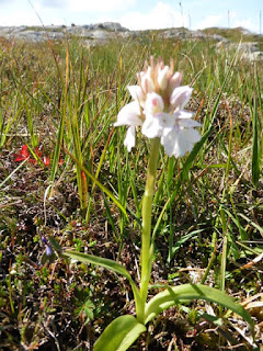
| An orchid |
From my time on the Polar Pioneer, I knew what this was -->
Back at the bottom I visited the small visitor centre, old school & church.
 |
| Inside the school |
 |
| The village church |
After the church I went into the gift shop & got Eileen (cat-sitter) a pressie & myself a fridge magnet & a CD.
Then I sat in the sun awaiting the zodiac back to the BE. I got the last one at 1350.
We headed back east past Bororay & the gannet colony.
Then the Lumix battery died, so the rest of the afternoon's photos are from the Nokia.
There is no zoom, & it's very difficult to see what's on the screen in the sunshine, so it was a case of Point, Click & Hope for the best!
 |
| Leaving Hirta to stern |
As you can see, they're not great, but at least they're Gannets :-)
Having changed watch last night, we swapped again & we were on the 2000 to 0000 headed east.
 |
| Dawn photo at 0445 |
Then I went back to bed till gone 8.
 |
| Swabbing the decks. Our 1st 'job' each morning |
After the deck wash Simon had his daily dip, but I left it for later: Taransay's water looked amazing.
Breakfast was a couple of bacon butties, then there were the usual relays in the zodiac to a rocky beach about 1/2 way along the eastern side of the bay.
 |
| The 1st zodiac heads shorewards, & ~ ~ |
The beach was full of lovely glittery stones (quartz??), so I put a small one in the bumbag & took a pic of a big one before heading up the hill ~ stopping half way up to catch my breath & gawp.
I swam out 100 strokes & a similar number back, then wrapping the towel round me walked barefoot along the grass track to the 3rd beach - a rocky one.
On the way I passed Clive who had been collecting wool. He does something with it, apparently, & had a small ruckie full of it to take home!
btw~there was a pic of the big beach with the BE anchored in the loch, plus one of Clive & co awaiting the zodiac, & one of the 3rd swim beach - the rocky one. However, during all the palaver with blogger, the chromebook & the Library servers going down while I was writing, they all disappeared :-( & Grrr
I had another quick dip off the rocky beach, & then it was time to go back to the BE for lunch & the trip to Lochmaddy on North Uist.
 |
| There wasn't much to do through the Sound of Harris . . . |
To get to Lochmaddy we had to sail the Sound of Harris: Caolas na Hearadh in Gaelic.
 |
| except take photos of the scenery . . . |
This channel is 8 miles long from SE to NW between Harris & N Uist.
The Visit Outer
Hebrides website says this:
The Stanton Channel has been newly
 |
| eat goodies for lunch, & . . . |
 |
| relax with a book & sleep in the sun. |
 |
| The 1st zodiac takes its load of photographers |
buoyed to avoid the reef and rock hazards, however crews sailing in the Sound of Harris are advised that carefully chosen timing is crucial as the tidal streams in this area are very variable.
Sailing through the Sound can be very hairy if you mistime the tide, & Lukas & Nikki 'discussed' it ;-p, but we had an smooth passage with many paying guests asleep on deck.
Lunch arrived at some point as well.
 |
While I photo him & Lukas,Simon spots a Minke.
As usual I missed it! |
Once we cleared the Sound & were in The Minch, Nikki sailed the BE around & about, & we took it in turns to get in the zodiac for photos
 |
| The BE under sail on The Minch |
of her under sail.
Some peeps saw a minke fin, but I was looking the wrong way :-( ~ as per bloody usual!
 |
| Shame I cut the flag off this one :-( |
 |
| Possibly the best of my BE pics? |
 |
| Almost front-on |
 |
| The zodiac was bouncing a bit, so I missed the flag again |
 |
| The BE from starboard. This is OK as well |
But at least I got some nice photos of the BE with all her sails up for my 'birthday card pics' :-)
I use photos I have taken to make my own, & all in all, I was quite pleased with my BE pics :-))
 |
| A sea-lagoon ~ somewhere off North Uist |
After our jolly in the zodiac, we sailed along the eastern side of North Uist towards Lochmaddy
 |
| This is either a cetacean or a rock - I can't remember! |
where we would overnight at anchor.
 |
| Clive on the helm as we approach our Lochmaddy anchorage |
 |
| Tilt your head left & this is a seaweed-man waving his hands ;-p |
Anchored in a still loch it was time for tiffin & a chance to get the binos & cameras out.
 |
| Someone spotted this deer on a hill . . . |
Someone caught sight of a large mammal & soon everyone was trying to see it.
 |
| Everyone else used eyes or binos . . . |
Happily, with the Lumix on Landscape mode, I had more than twice the usual 40x zoom & so got a reasonably clear shot of a red deer doe on a hillside.
 |
| I used the 90x zoom on Landscape mode for this one |
 |
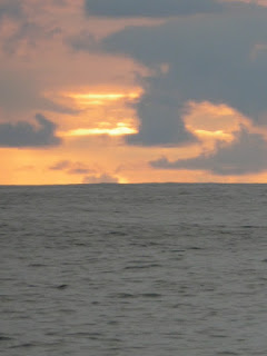
| Lochmaddy sunset at 2310 |
After dinner, the sun stayed up for some time - as it is its wont in the northern latitudes in summer.
 |
| The weather closes in . . . |
 |
| & the land is under low cloud |
 |
| The 3 wise monkeys ;-) |
IMO, apart from when we saw dolphins, it wasn't a great day.
We were all fairly wet & miserable, but kept our spirits up by being daft whenever possible ;-)
We were headed for Loch Harport where the Talisker Distillery was & I was looking forward to a warming malt after that sail!
 |
| The Old Inn |
 |
| Inside the pub |
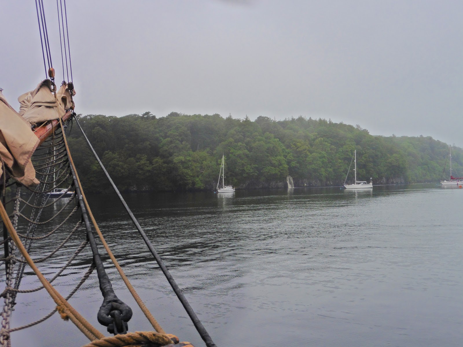
We anchored & then all the passengers went ashore in the zodiac to the Old Inn where there were public showers (we had been 'discouraged' from using the BE's due to a cracked water tank).
After our ablutions, we all got together in the pub for a drink, though it was heaving with peeps & most of us ended up sitting outside with the smokers :-(
It wasn't very warm out on the terrace, so I was glad when the zodiac arrived to take us back for dinner.
I didn't know then, but I was going down with a bug :-(
Dinner was excellent again, but early the next morning it came back up!
But that's in Part 2
OAO
 At Oban I walked to the pier to find only Pete (the chef) aboard, so dumped the ruckie & had a wander.


