Thursday, 1 March 2018

NZ16-3: Feb 25th & 26th~Akaroa to Kaikoura

Feb 25th: Akaroa to Christchurch
Anna & I were fairly on the ball & set off to explore some of the northern bays of the peninsula just after 9. There was 3903.4K on the clock.
Looking across Pigeon Bay to the SW

The 1st place we stopped was Pigeon Bay, & we got out for a walk along the eastern bank at Bonanza Time - AKA ten to ten (It's an English thing, so don't worry if you don't get the joke ;-p )
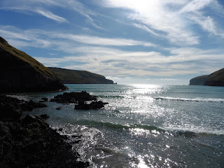
East shore of Pigeon Bay

We walked along the eastern shore for a while, & we picked up a few nice bits of paua & other shells (Pics below).

We were back in the car by 1040, & I drove by way of Hill Top, Little River & Gebbie's Pass to Diamond Harbour.
Looking across Lyttelton Harbour from near Stoddard Point

I followed my nose down Waipapa Ave., & parked at the end near the wharf at Stoddard Point. 
We had a bit of a walkabout around the 'Recreation Area' there: This included a big ice cream from the cafe-stroke-general store at the top ;-p
We also walked down to Purau Bay, but it was full of flies & I didn't fancy another episode of sand fly swellings like in Northland 2014 so we just had a look & left it at that!
While we were at the Wharf, I got talking to an English couple from London who were holidaying with their 2 young lads. The lads & Dad were having a great time jumping into the water off the wharf. 
I'd've joined in, but we had a few miles to go yet & it would take time changing & drying off.
Looking back towards Diamond Harbour on the way to Lyttelton
We took the scenic route round Governor's Bay, stopping a couple of times for photos showing where we'd been that morning.
Ditto across Governor's Bay
We arrived at Lyttelton at 1320, having covered over 120K!
Gosh!
Littleton isn't very picturesque, but we found a nice bar-cum-cafe on a corner, & got some lunch. We ate outside looking back across towards our morning's explorations, & Anna talked to the bf about where she should be in order to hook up with him & his family.
Reading between the lines, I think Anna had enjoyed being on her own, & able to do what she wanted, when she wanted, & wasn't too fussed about joining them! 
I often wondered how she got on, & whether or not they stayed together.
Back in the car, we went through the tunnel from Lyttelton to Christchurch which comes out to the south east of the city.
Quite a few buildings were missing due to the 2011 quake, & my memory of the city was scuppered significantly by the changes wrought by big gaps where buildings had been, or new, modern, buildings where I remembered the old ones, but I found Worcester Boulevard eventually, & checked in at Rolleston House YHA.
The car had to be back near the airport at 1630, so I off-loaded everything, then dropped Anna off at the bus station at 1535 before heading out north west to Lucky Rentals. I figured 55min would be enough to travel less than 12K.
Bloody hell. 
Talk about traffic! 
It took me ages to get there because the road signs to the airport weren't helpful, & I caught nearly every red light going. In the end I detoured to avoid the queues, & got there only a bit late.
The exchange was quick & I legged it down the road towards Hornby for a bus back into town. It came within 5 minutes, & was supposed to take 17. It took more than twice that to get back to the bus station. 
Walking back to Rolleston House via Columbo & Worcester, I had a look at the poor cathedral.
Quite frankly, it was a mess in comparison to how I had seen it in Dec.'9.
The tree survived :-D  See 2009 pic below

The front facade of the cathedral,
held up with scaffolding in 2016


What a disaster for the city the earthquake in 2011 had been, with many of the old buildings I'd enjoyed looking at in 2009 wrecked or gone completely. 

See the blog: Sunday: Nelson to Christchurch, & Monday: Christchurch from December 2009 & the 2009 pic below.
Check this 2016 chess/cathedral pic in 
relation to the one below from 2009.
You can see how beautiful the cathedral had been


They keep the chess in this box!

Christchurch main square & chaps playing uber-chess! 


I lifted this pic from the More NZ touristy pics  blog I published in January 2010.

I thought I had taken more of the Avon, & various buildings in the city centre, but there's nothing on the hard drive or in any other blogs.
I defo missed a trick, there. Shame :-(
Back at the Y it was time for tea (AKA leftover fish & chips from last night & the Okains citrus slice ;-p), & I got chatting to a bloke from Southport in the dining room. He kindly lent me his UK adaptor for the mob, camera & Sanyo. I did some blog notes & sudoku over the free tea & a mug of Straight 8 vino, then repacked & showered before bed at 2115: I had a Naked Bus to Kaikoura at 0700.

The bits from Pigeon Bay


Feb 26th: Christchurch to Kaikoura
I got up at 6, ate 2 bowls of porridge, had 2 cups of free tea, hefted my bags, & walked round the corner to the bus stop.
It was still dark.
As well as passengers, a bloke took his bike with him & I wondered where he was going.
The bus began to leave on time, but pulled up immediately for a very late arrival who hugged & kissed his mum before running across the road for the bus.
I had a seat behind the driver, 2 rows back.
The Victoria Clock Tower as dawn breaks
We passed a cute clock tower a few minutes after departure, & the sky was getting lighter.
I quickly took a blurred pic as we passed it ;-)
As I had no idea what I'd photographed, I E'd the Christchurch i-Site & asked.
Of course, the lovely NZ folk came up with the goods again ~ this time, Jaya, who sent me a link with some info:
Diamond Jubilee Clock Tower. Also known as the Victoria Clock Tower, this volcanic stone and limestone structure has ornate wrought iron work with coloured glass around part of the tower and four clock faces. The tower has two white marble plaques and one bronze plaque set on stone work above arches. The upper part of the structure was designed by Benjamin Woolfield Mountfort and constructed in 1859 in England. Originally intended to have been incorporated into the Canterbury Provincial Council buildings complex, it was too heavy for its intended site. In 1897 the structure was incorporated into a memorial clock tower for the 60th Jubilee of Queen Victoria's Reign, with a stone base at the intersection of High, Lichfield and Manchester Streets. The tower was relocated due to traffic volumes, and erected on its present site in Victoria Street in 1930. The clock stopped and the finial bent with the force of the earthquakes. The tower suffered structural and stonework damage which has now been repaired and strengthened.
There was a bloke across the aisle who asked where I was from & what I'd been doing & seeing in NZ. I told him this was the 4th trip, & related a couple of my adventures, including the kina tale (see blog NZ14:Days 13 & 14-Dec 2nd & 3rd~East Cape to Stuart's via Morere Springs & Gisborne). He said it was great & one of his favourite foods! 
Clearly, I'd lacked the knack of cooking it back at Morere Springs!
Sunrise from the SH1 north
Once on the SH1 north, the sun was defo rising, so I nabbed another blurred pic.
At least the windows were clean!


The bus was going to Picton, & we were due to arrive at Kaikoura (the 1/2 way point) at Bonanza time (see above ;-p) 
Unfortunately, I have no notes about the journey itself, but I remember
Pointy peaks. No idea what they are!
it was great, with some views of pointy mountains near Waipara, & great colours in the bush.

Despite the 2 bowls of porridge at 0630, I was peckish, so while I was on the bus I had some Graze rice crackers & cottage cheese, & other bits left over from Akaroa. 
On the way up the coastal section of the journey, there were penguins & seals in the water & resting on the rocky shoreline, but we passed them too quickly for any pics. I remembered we had also seen them from the bus when I travelled down from Nelson in 2009.
Approaching Kaikoura I spotted a dun horse & a sign about a cave, & decided that was what I'd do 1st.
The Kaikoura bus stop was right across from The Fish Tank hostel where I was booked in overnight, so I checked in, dumped the bags, & walked back to the caves. It was about 2.5K going up to the SH1 & back down along the straight to the caves & cafe.
There were bacon butties on offer, so I had one & a brew while I awaited the 1230 tour. I also grabbed a few sachets of sugar, as I was totally SC at Waipara.
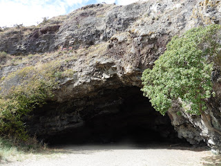
We were given hard hats & a safety chat before heading through a door into a hole in the cliff behind the cafe. 
The safety brief outside the entrance

At this point, my notes are very muddled! Greywacke's in there; millions of years; limestone reducing the effect of earthquakes; & a sea urchin fossil.
Not very coherent!

Therefore, I'll let the pictures tell the story.
The door to the cave

I took this rock pattern for a reason!  Um?

Cheesy-looking deposits


A pair of boots. Similar 'things' are at Mother Shipton's
cave in Yorkshire (incl. dolls & teddy bears!)


Stalactites & stalagmites


Alien-looking growths


More aliens!


A closer view of the boots


Yum, yum. Tripe ;-p  Hehehe


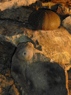
Fossilised sea-urchin & a recent once above it


More interesting patterns on the cave wall


While writing this blog, I discovered the cave is currently closed.


There had been an earthquake near Kaikoura in November 2016, resulting in the sea floor being raised a metre, landslips north & south of the town, big chunks of the SH1 moving, the Picton-Christchurch railway line coming adrift, & the cave being closed.


I guess the magnitude of that quake was too much for the limestone to cope with?


Back outside I got acquainted with the dun with the help of the grass my side of the fence. The stuff on his side was a bit brown & dry.
The nice dun horse I'd seen from the bus
He seemed to appreciate it & posed nicely for a pic.
The Barney lookalike :-D
Barney & me

When I was 13 I got a dun pony for my birthday: That's him in the 3rd pic, taken when I was 15.

I hitched back to town & got a ride with a Dutch guy who recommended the seal swim. However, it was a dolphin swim I was after, so I went to the tour peeps & got myself on the wait list for tomorrow's 0500 & 0830 tours. 
My bus to Waipara wasn't until 1600, so I had loads of time. They would call me tonight if I'd got on the 0500, & early tomorrow if there was a place on the 2nd trip.
I walked back to the hostel along the shingle beach. It was full of wave-made ridges, & I picked up a lovely white stone with bluey-grey markings on it.
Shags & red-legged gulls hanging out

Near where the river came out there were birds resting on some rocks jutting out into the sea.

I think it had been a blue penguin,
but it was now a sad corpse on the stones.


A bit further along the beach I found a dead penguin. Poor thing :-((


I continued scanning the stones underfoot until I was more or less level to where the railway crossed the Esplanade & the SH1.
I was well into beachcombing by this point, having found a small pink paua shell as well as a large blue one nearly as big as my hand.
Back at the Fish Tank, I did a full check-in & was allocated a bottom bunk in room 7.
At some point in the proceedings I attempted to take photos of my Kaikoura & Pigeon Bay treasures by laying them out on the bunk, but with the dark blue background the flash kept going off. As you can see, it wasn't right successful, so I took a few more today ~ 28 2 18! 
Better late than never, eh? ;-)
Kaikoura treasures. Incl.the pink paua & the nice white stone
Taken at 171 on 28 2 18


Scallops & a small Cook's Turban

Kaikoura treasures: pt 2. A rather blurred ( ;-p ) pink & blue paua

This is the blue one, but the flash reflected too much
when I photographed it on the Fish Tank bunk .  .  .
2 better versions, taken 28 2 18!
The paua came out marginally better using the Lumia camera, I think?
My thumb & a glittery bit ;-p

I fancied crayfish for tea ~ well Kaikoura was famed for them, & I cased a few joints for the best deal.
As the best deal was 48$ for a half crayfish, I decided not to bother in the end, & went to the FourSquare. I had some Akaroa cream cheese left so I bought pasta. I also got some licorice for the bus (& pudding ;-q), milk & feijoa cider. Tea & coffee were free at Fish Tank, but you had to supply your own milk, & I'd need some for Waipara, anyway. 
The view looking north from the balcony when I had my tea
I ate my pasta, cream cheese & a licorice stick on the balcony, & swigged the cider while the sun went down behind me.

Taken from Fish Tank's balcony just before bed
Notes & a quick Email check came next before heading back to room 7. There had been no call about a dolphin swim :-(( 
Before bed I decanted the last of the Straight 8 into the plastic cider bottle to save on weight (I'd be car-less till Picton on the 29th), & chatted to the other occupant of the dorm ~ a girl from Sri Lanca who was on the 0500 trip. 
Lucky devil!
I went to sleep hoping for an early morning telecall telling me to get down there for a dolphin swim.
OAO

Friday, 23 February 2018

NZ16-2: Feb 23rd & 24th. Tekapo to Akaroa & the Banks Peninsula

Feb 23rd: Tekapo to Akaroa
I woke naturally at 0704, & after trotting down the corridor to the loo, I decided I might as well get up & get an early start. After all, the sooner I set off, the sooner I'd get to Akaroa ~ somewhere I'd been trying to visit every since I'd 1st heard about it in 2009.
I'd soaked my oats the night before, so shoved the bowl in the m/wave, & brewed up.
I went online to check Es over porridge & coffee, packed the car & checked out, setting off back along the 'loopy' (check a map!) SH8 towards Kimbell at 0845.
You may remember Kimbell? I stayed there in 2011 during my RWC/Ski trip.
I got there in 20 minutes - Burkes pass was very quiet, so I'd let the right foot do its job ;-)
I reversed the route I'd driven yesterday, stopping at the Udder Dairy again for a bacon butty & a brew.
A workman's boots: cast off so as not to
take crud indoors!

I took photos this time.

There was a blackboard outside, requesting muddy boots were removed before entering, so I had to get a photo of that.
I'd never seen a shop of any description before which had 'turned Japanese'.
There was cute crockery as well, so I arranged my cup, saucer etc., & got evidence of bacon butty eating.

After the butties, it was about 1015, I had 3646.4 on the clock, & it was time to do the Thompson Track again.
The sign said it was 52K to Rakaia this way, & I remembered to note my speedo on the straight bits. The longest one was 41K with only slight curves as it went round entrances to fields at the gate.
Without checking, I think that distance has blasted the straight bits west out of Christchurch into the water. I must look at the blogs I did at the time.
I fueled up at Rakaia at 1135, & went left onto the SH1 north.
While I was driving along (I can tell by the wobbly writing ;-p), I noted that the bridge over the Rakaia River was well over a K long. 
They like things long & straight here, eh? ;-)
I got this off Wiki:
Immediately north of the township are New Zealand's longest road bridge and longest rail bridge, both of which cross the wide shingle beds of the braided river at this point. Both bridges are approximately 1750 metres in length.
My right turn off the SH1 (with 86K to Akaroa) was on the Straight 8 corner, & it took me to Lincoln & then Tai Tapu; both townships which were reminiscent of 1950 movies.
Turning right onto the SH75 at Tai Tapu there was a guy with his thumb out, so I stopped & picked him up. He was Tristan, a student at Lincoln Uni, & was off to work at the DOC Reserve above Akaroa. I think it was the Hinewai on Long Bay Rd
SH75 went more or less south east along the eastern edge of Lake Ellesmere, before turning north east & over the hills towards Duvauchell.
Wiki says this about Lake Ellesmere:
Lake Ellesmere / Te Waihora is located in the Canterbury region of the South Island of New Zealand. It is actually a broad, shallow lagoon located directly to the west of Banks Peninsula, separated from the Pacific Ocean by a long narrow sandy spit called Kaitorete Spit, or more correctly Kaitorete Barrier. The lake holds high historical and cultural significance to the indigenous Māori population and the traditional Māori name Te Waihora, means spreading waters. It has officially had a dual English/Māori name since at least 1938.
I thought I stopped for a pic, but apparently not!
After the turn to the left, there was another lake to the right: Lake Forsyth. It was very green, but Wiki says this was due to algal blooms, & that the lake is very toxic ~ having killed sheep & pets who drank from it. Gosh! 
And it looked so nice!
Duvauchelle off shot to left & Akaroa above the tree on the right

Once over the hills, the inlet of Akaroa Harbour 
appeared, & I pulled over for a pic.
Tristan said he'd walk from the Long Bay Rd junction, so I dropped him & his big ruckie off at the top of the hill. According to Gmaps, he had a 3K walk to Hinemwai.
Next I headed down the hilltowards Akaroa where I was staying for 2 nights at the Bon Accord Backpackers on Rue Lavaud.
As you can see, there was a lot of French influence here.
I arrived at 1333, but check-in wasn't till 1400, so I had a walkabout, & found this cute little church just round the corner.
St Peter's Anglican Church. I didn't go in

Jade checked me in at Bon Accord, & told me there were home-made cakes later. Oh goody :-q

I was in a mixed dorm. 
Good job I had something to sleep in then, given my need to get up in the night!
I unpacked & changed for a proper walk in the sun, setting off down Rau Lavaud towards the beach ~ which I found where Rue Lavaud changed into Beach Rd.
Sea shells on the sea shore
Of course, I had a paddle ~ French Bay was fairly sandy, picked up some shells along the way, & took photos of them & birds I saw.
My hieroglyphics say these are NZ mallards

The pied shag with the hills to north


Mr (Mrs?) Pied Shag posing


Apart from the walk along the beach itself, I walked all the way along Beach Rd to Main Wharf, noting a good looking fish'n'chip shop, & various gifty & excursiony-type establishments along it.
The little lighthouse from Main Wharf
There was a fair bit to do here, but I actually had less than 2 days: I was due back in Christchurch by 1630 on the 25th. 
Back on Beach Rd., I made my way up hill towards the little lighthouse I'd seen from the Wharf. As usual Google came up with some info about it:

The original Akaroa Lighthouse started operation on the headland of Akaroa Heads in 1880. One hundred years later, it was moved down to Akaroa Township, after being replaced by an automated light. The foundations are all that remain of the lighthouse keeper’s family homes, but the original stonework of the supply road down to Haylocks Bay remains along the cliff face, including an original stone culvert at the junction of the road & the small stream. 
Aforementioned lighthouse


Somewhere along the way I must've found out about the 3 Rhodes brothers who more or less settled the Banks Penninsula. 
At least, the scrawl down the side of my Gmap says "3 NZ brothers".
Umm ??


My notes also mention the Tane Garden of Remembrance, & I remember having a meander up the hill into the woods. However, while I also wrote "up by cemetery", I have no pics of the Tane Garden. Maybe next time?
The track out & down came out on Beach Rd between the lighthouse & the yacht club, so I turned right back towards town where I found an awesome ice cream kiosk :-)
Rata or Ficus?
Post ice cream I saw these lovely flowering trees across the road from the beach.
I showed this to a local in the 4-Square & she
wrote down Ficus Ficifolia, but I think it's a Rata


At the 4-Square ~ where I went for cheese to dip the Graze rice crackers in, I asked at the till what it was, & was told 'Flowering Red Gum'. tbh, I'm not totally convinced.
It looks like a Rata to me??
Back at Bon Accord just before 5, it was time for buns, but I held off until I'd reheated the mussel patty from Christchurch & the final helping of the chips. Well, I did say there were a mound of spuds. If I could remember where it was, I'll go there again next time/if I'm visiting Christchurch. The bun did for a pudding, & I sat in the garden on a bench/table to eat, & to drink my brew & the rest of the Straight 8 fizz. I kept myself company with a crossword, but I got bitten by bugs, so I ended up on my soft bed & fell asleep till about 7pm. 
Needing to go online to check-up on the cats, I sent a couple of Es, but both bounced back. Bummer :-(  
Instead, I soaked some porridge for breakfast & tried to catch up with the notes for the flight, Christchurch & the drives to & from Tekapo. Unfortunately, but the bod wanted to catch up with lost sleep, & so I'd settled down for the night by 2000.
Thus ended my 1st sight of Akaroa, & I was looking forward to having a good look at the Banks Peninsula in the morning.
Feb 24th: Exploring the Banks Peninsula
Having closed my eyes very early, they opened at 0705, so got up & showered before the rush.
Jade had given me a local map, so I planned to head out to Le Bons Bay first & then see Okains Bay: both on the NE cost of the peninsula. I was away before 8, & at some point up the hill or along Long Bay Rd I stopped for some scenery.
Looking across Akaroa Harbour to the west?

Akaroa from near the Long Bay junction
Like I said, I took Long Bay Road, & it was long (poor Tristan ~ I thought about him with his big ruckie when I passed the entrance to the reserve). 
It was nearly 5K before the left turn onto Summit Rd., another 4K to the turn onto Le Bons Bay Rd., & 9K down to the beach.
Le Bons Stream looking seaward
On the way down I passed a guy taking a morning constitional ~ with virtually no houses, & certainly no paper shop, that must've been why he was striding out?
I stopped to ask him why the growth was brown on the left of the road & green on the right. It was quite bizarre.
He didn't know: he wasn't a farmer & just had a bach down by the beach. However, like nearly every Kiwi I've met, he was very friendly & helpful, & told me about a walk to the river which sounded nice.
I took his advice & pulled off to the right, & found a track going up & over a little rise, & then down to the river.
It's called the Le Bons Stream on the map, but it's like a river.
I walked along a little way, but the tide was flowing in, so went back to the car after a Rule 10 & a photo.
Back in the car I went down to the beach & parked under a cedar to write some blog notes, take on some sustenance, & have a think about a swim.
I decided against a swim because it was quite windy, & the walking looked like a better thing to do.
There were 3 camper vans parked there already, & 2 blokes were cooking/eating a big fish. There was also a row of houses/bachs just inland of the sand dunes, but they seemed to be empty & shut up.
Once over the dunes & on the beach, I went right towards the Stream first, & saw a lot of interesting shells lying about. The 1st one I picked up was a Cook's Turban, or Cookia Sulcata.
According to Google, this is: a species of large sea snail, a marine gastropod mollusc in the family Turbindae, the turban snails.
Pretty pinky/purple Cook's Turban.
They come in other colours, as well

Turning it over, I discovered this turban was occupied!
The beastie inside the shell
There would've been plenty of meat in this mussel


Obviously I left the beastie where it was, but picked up other shells, including a lovely, big,  mauve lipped mussel.


Le Bons Stream looking inland

I walked until I could see the bit of the Stream where I'd taken the photo looking towards the sea, & took one in the opposite direction.


Then I turned round to walk all the way along the stream to the sea, & then across the beach to explore the other side of the bay.
The Le Bons Stream estuary


The sand was quite hard, having dried out a bit during low tide, but it was coming in slowly.

Walking across the beach I spied a strange rock formation at the northern corner of the bay. 
Highly zoomed rock castle at entrance to Le Bons
The pic shows how it looked at max zoom.
It was a bit crenellated like a castle, but almost like a dragon's head, as well? 
Or maybe I've just been watching too much Game of Thrones?? ;-)
See what I mean about it looking like a castle?

The view along Le Bons Bay up to 'The Headland'
Walking along I spotted what looked like a road leading up the headland to the north, & decided to take a look later.
Teeny weeny mussels on a Le Bons rock

At the other end of the beach I found a baby mussel nursery. 
Aw.
I hadn't realised mussels came that small.
Aren't they cute? You can (sort of) see how small by the size of my boot prints in the sand.
Looking east out of Le Bons Bay
Back at the car, I had a quick swig of ginger beer & some fruit before taking Lavericks Rd. up to the right. It was very steep, made of dirt/gravel (well, this was back country NZ), & had quite a scary drop to the right.
Le Bons from Lavericks Rd.
I stopped half way up for a pic, then came across a load of Ramblers as I went round the bend at the top.
Not really knowing where I was going, I asked them the way to Okains Bay, & someone said Dobson's Track would take me down there, so ~ in between gawping at the scenery, dodging farm traffic, I kept my eye out for a likely-looking track/road off & down to the right.
Not positive, but I think this little bay is Laverick's: it's
 about the right shape, according to the map. It was the
rotted trees which grabbed my attention from the road
As it happened I completely missed it, & I can't see it on Gmaps either %\
Consequently, I ended up on Summit Rd. again, but getting down into Okains Bay was a piece of easy thing from there :-)
Driving down to the beach - just before the straight bit on the valley floor, there was a Maori & Colonial Museum, & I decided to have a look on my way back. 
There was also a campsite in the corner between the beach & the Opara Stream, so I parked up & had a quick visit to the Ladies before heading beach-wards. 
Okains Bay beach from the east end


It was another nice beach with some interesting shells, rocks etc.
Coloured rocks, Okains east


If it'd been warmer, I'd've defo had a swim, but there was still a brisk breeze, & wasn't right sunny.


The Ages of Mussels ~ with apologies to
Hesiod, Ovid & Erikson ;-p


I spent a while moseying around, scrambling over rocks, walking along a track underneath the cliff towards Little Okains Bay (I didn't go all the way there), & taking photos before heading back to the car.


Okains cave


A workman gives it the boot!
Or maybe the sock?


The drop-kick
Teeing up.
Or should that be booting up?


When I got there, I wasn't 
Totally 
surprised to see some blokes 'messin' about with their balls' ;-p.

With typical Kiwi ingenuity & the love of the game, they were using their boots as kicking tees, & kicking in their socks. 


Could've been painful! 

I'm sure I would've stubbed my toe, big style. 
But then I'm crap at kicking!
Kicking balls, anyway ;-)


Just before I got back in the car, I took this:
This saved me writing it all down, but it's
a shame I missed some of the R margin :-/
I went for some food at the store near the museum next. According to the Brief History board, it first opened in 1873!
It doubled as a cafe, too, so I had some Okains Bay Store haute cuisine on a lovely china plate.
Feta & leek roll with a long black.
Notice the lovely china!
I also got a cake for later.

While I was eating, the local postman arrived. He had 'paying guests' with him, & I see from the local I-site you can get tours with the postman.
This must be dead handy if you've no car, or simply not into exploring yourself.
Plus, a handy local telling you stories, as well. Probably?
Postman Pat. Or maybe Bruce, Taika, Manu etc?

It wasn't that warm & sunny, but as a local ginger cat used my car as a parasol, there had to be a photo!
Ginger cat under my car
After lunch I went to the museum, which seemed to be a classroom for the local children, & there was quite a lot going on.
The Marae at Okains museum
Dodging the sproglets, I had a look at the Marae ~ taking a couple of pics, & poked my nose into the other exhibits.
Ditto

The Brief History board had also explained that the site of the museum was where the Cheese Factory had been.

It had opened in Feb.1977.
I spent nearly an hour in there, admiring the Maori weaponry (I so wanted a Mere), & all the other things on display.
 
Image result for okains bay museum
The next 2 pics are off Google.
As you can see, there were a lot of artifacts on display


Once done on that side of the road, I crossed to have a look at the Waka in their shed in a field! 
Image result for okains bay museum
The 2 ceremonial Waka in their shed

Google says the Okains Bay Waitangi Treaty event is the longest established one on South Island.

It also says you can go out on the Opara River for a paddle in the Waka.
That would be fun :-)
The Okains phone box

As it says ~ the Okains bay Store
Culture over ~ for the time being at any rate, I took my last 2 photos & headed seawards again. 
Looking back into the Okains Bay estuary
from Chorlton Rd.


This time I turned left before the beach onto Chorlton Rd., intending to go up & over the top again. This time towards Little Akaroa.


The river meets the sea at Okains Bay


At the top of the hill there were some sheep on the road, so I went up the nearest drive & eventually (via some barking dogs) roused a woman out of the house. She said she'd let the owner know.

After doing Street View on Gmaps, I discovered
this is Raupo Bay
A bit further on, I stopped for a pic of another lovely bay - but there were so many great sights, I couldn't take photos of them all!
Dropping down into Little Akaroa I lay on the roadside to take a pic of some pretty blue & white flowers & a blue & white sky.
It took me bloody Forever on Gmaps to find out where this was!
Little Akaroa beach from the east end
At the beach I decided to have a swim, & changed in the loo for "Women". No Ladies here, eh?  ;-)
The car was sheltering under what I'd thought was a big yew tree while I swam out to a buoy, but I subsequently found out it wasn't Yew, & wrote down what it was.
Somewhere??
The car & the tree I thought was a Yew


No doubt I'll read its proper name at some point while I blog NZ16. 


Mind you, the hieroglyphics are occasionally beyond me, even though I wrote them!
Back on shore, given the lack of 'facilities' in the Women's room, I washed the salt off by rolling around in the shallow river, & watched a woman from a nearby house gathering seaweed for her compost heap. She said there'd been a cyclone from Fiji & it had brought seaweed up into the river mouth.
There was a diving platform pulled up on the beach, so I lay on that for a bit to dry off. While I was lying in the sun, I also wrote up some notes & did some puzzles from a Metro I'd found on the train down to the airport. The wind had dropped a bit, & it was lovely & warm & peaceful :-D
Dried off & back in the car, I reached Summit Rd at 1640, & headed back to Akaroa for some tea.
I remembered seeing a fish'n'chip shop on the Wharf, so parked up & headed there. Murf said he only had Waihoa left. 
At least, I think that's what he called it, but I can't find any native NZ fish with anything like that name. Um??
Possibly it was Warehou, & possibly a kind reader will put me right??
Murf's Fish & Chip shop on Main Wharf
A mug of chowder & some chips went with the fish, & it was an awesomely yummy tea :-q
Murf
As is normal in NZ, Murf was very friendly, & helpful, even though it was only minutes to 5 when I got there, & he was in the middle of shutting up shop.
I found a picnic table just south of the Wharf, & sat in the lowering sun for my tea.
Lovely :-D
My tea table in the setting sun


Replete, I drove back to Bon Accord, & began to pack - I was headed to Christchurch in the morning, but planned to take in as much of the rest of Banks Peninsula as I could on the way.
Over a brew & a bun in the kitchen, I got chatting to Anna from Germany. As is common with Germans, her English was excellent, & I found out she had to be in Christchurch as well the next day, but was planning to hitch: the buses weren't at all frequent, & that was the main reason I'd opted for a car.
Anyway, I offered her a lift, as long as she didn't mind taking the scenic route ;-p
Deal done, we arranged to leave about 9, & I went for a walk in the opposite direction to yesterday evening.
Akaroa's St Patrick's church
A little way along the road I found St Patrick's, an awfully cute little building.
It was like something out of a fairy-tale.


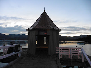
Daly's Wharf & sunset over Akaroa Harbour
Then across the road by the shore, another cute building on a short pier.

While writing this blog, I asked the Akaroa I-site about the building on the pier, & Doreen got back almost straightaway (given the 1/2 day, 1/2 a planet distance between us!), & said it was Daly's Wharf.
I also asked about Murf's Waihoa, but I guess I got the spelling very wrong, & she couldn't help me with that one ;-)
However, she did suggest I ask the Akaroa Museum, so I did. I also sent a pic of St Patrick's, & Lynda replied with this:
We don't have a lot more about the Daly's Wharf shed - it's history is elusive.
However the church you've photographed is St Patricks Catholic church, built in 1865 with the tower added in 1893.
Hoping this is helpful to you,
Kind regards,
Lynda
So that's how I found out.
My evening stroll was lovely, & rounded off a great day on Banks Peninsula.
Back at the Bon Accord, I did some sudoku & drank the rest of the Straight 8 riesling while my bits & pieces were charging on someone's charger. I finally hit the sack at 2130 with the alarm set for 0745.
So endeth Day 3 of NZ16.
   
As I write, I'm aware that tomorrow is the 2nd anniversary of this day, & I have 23 days of NZ16 to blog, 2017's holidays to do, & various other blogs about home, Edinburgh & my Brathay volunteering trips.
Gordon Bennett! 
Trouble is, as I blog, I wonder about stuff, ask Google, & end up spending ages finding out things I never knew about where I'd been.
It's great, & I don't suppose this leopard will change its spots anytime soon ;-)
But for now ~ Over & Out