Don't ask me how that 1st place is pronounced, just take it from me that it's awesome!
However, before we got there, were were boarded (in the nicest possible way) by a Norwegian Pilot just north of the Sor Gjaeslingen archipelago.


We then did a Uey back towards the archipelago which was Sor Gjaeslingen.


On the way we passed a cute little lighthouse on a 'rock'.
We weren't as close as the pics suggest, but the camera had a 40x zoom.

 |
| One of the Russian crew ~ despite the dreads! |
 |
| Another arty-farty photo through the window |
 |
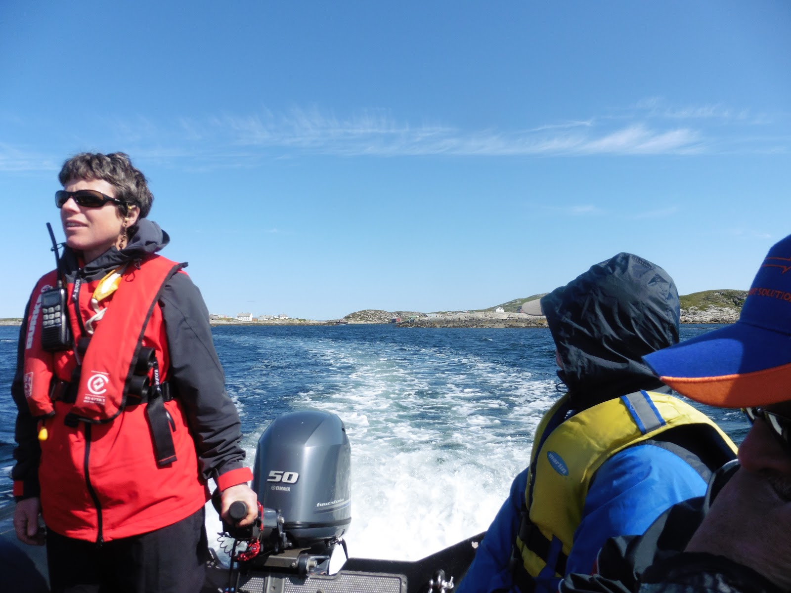
| You can see we were ready for the off in our yellow life-jackets |
 |
| Away from the PP with Robyn at the tiller |
 |
| The Sor Gjaeslingen archipelago |
I was on the 1st zodiac off, & we headed to a village where the local bus was a boat.
 |
| I think the A-frame was for drying fish? |
 |
| That red paint turns up all over! |
 |
| See what I mean!? |
 |
| Kittiwakes nesting |
There was plenty to look at: all very cute & other-worldly.
There were kittiwakes on nearly every house, & I was lucky enough to get a few pics of their chicks during the morning.
 |
| More red paint. There's a lot of it about in this part of Norway! |
 |
| The |
 |
| I think the tide must have been out? |
 |
| They were getting ready to cast off. See later today for pics of her at sea |
 |
| I'd spotted a little fluffy head . . . |
 |
| So zoomed in for these |
 |
| So cute :-) |
 |
| Aw! There were 2 :-)) |
 |
| Double cute, or what? |


The coffee was in a plastic cup & the waffle on a paper plate.
I guess washing-up water may have been at a premium, despite being surrounded by the salted version?
 |
| The 4 Aus lads messin' about by the shoreline |
Then it was back to exploring.
 |
| This pic ended up in the Expedition souvenir book |
 |
| Andy finishes a pancake, before tucking into his 2nd ;-p Other PP-ers were tucking-in, too. |
 |
| Deirdre gets hers |
 |
| Finger-lickin' good ;-q It seemed like nearly all the PP passengers had pancakes |
Back at the cafe for a 2nd helping of brew, Andy was tucking into 2 waffle pancakes, & Deirdre & others were also treating themselves.
Not that it was necessary: the puds were good on the PP.
But we were on holiday, eh?! q-)
 |
| More red paint & a little garden by the sea |
Next job was a trip up the little hill for some views.
I got some nice flower pics as well
 |
| A violet |
 |
| Islands in the sun, with the PP on the horizon at about 2 o'clock |
 |
| My notes say these are cloudberries, & Wiki says they're edible. I wish I'd known: They'd've gone the same way as the waffle pancake! |
 |
| A view from the hill |
 |
| To get to the shop, the church or the pub, the folk in these 2 houses would have to take to a boat |
 |
| Err? Pinks? |
 |
| A plethora of violets |
It seemed nearly all PP's passengers were up there, & it was quite difficult to get a non-human view!
So, I decided to walk out towards the edge of the island we were on, & try & find somewhere to swim.
On the way I found loads of summer flowers, some more violets by the path, & some great views across the archipelago.


 |
| I was hurrying to get this guy before he flew off, hence the blurring |
After taking pics in various directions, I spotted a small pool in an inlet in the rocks with a likely looking spot for a dive in.
Skirting the pool, I made my way anti-clockwise to where I planned to plunge.
Doffing the shorts etc., in I went & had an amazing splash around in gorgeous clear & weirdly buoyant water.
Unfortunately, climbing out over the rocks I slashed open my hands & shins, & with all the water running down, it looked like I'd done a murder!
 |
| I dived in from the grey rock at 10 o'clock |
Oops!
I guess I'll grow up one day, & stop doing daft things?
Maybe?
Maybe not ;-p
I was with Heidi on the way back, & got some good pics of fellow PP-ers & the kayakers paddling home.

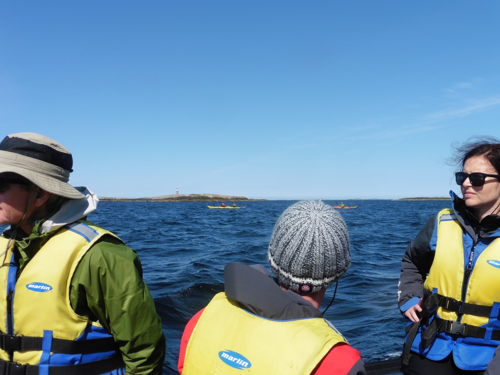 |
| The kayakers on the way back to the PP |
 |
| Michael also thought they were photo-worthy! |

Back aboard I watched the paddlers arrive & got pics of the palaver of getting them & their craft back on board & stowed.
It was clearly a bit tricky wearing all that wet-weather gear.
 |
| They pull up by a zodiac, climb/roll into it, & . . . |
 |
| eventually |
 |
| extricate themselves! |

Anchor up, we set sail for Leka, & on the way I caught sight of the cog I'd seen moored at Sor Gjaeslingen, so zoomed in & got a few of her under sail.
 |
| That gunwhale looks awfully close to the sea! |


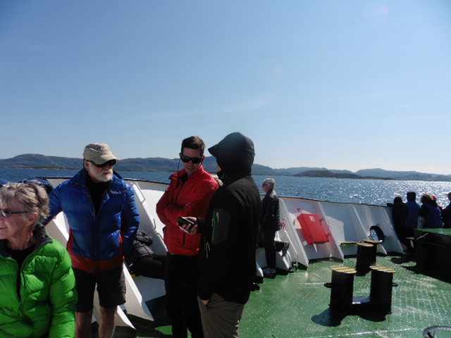
Lunch of Mediterranean pasta & salad was served as we headed north to Leka.
 |
| Peeps taking a leaf out of my book & having a sunbathe. It was a lovely day :-) |

 |
| We approach our next stop ~ Leka |
 |
| All aboard the |
 |
| We leave the PP for a trip to Leka |
 |
| The wind got into Michael's gf's hair |

I'd left the bikini to dry in my cabin or I'd've been in again at Leka: the sea was so clear & inviting.
However, we were there to find out about Herlaugshaugen: the burial mound of the Viking King, Herlaug.
 |
| Herlaugshaugen |
 |
| Carol & the Snorri Saga |
Carol got us all up top of the mound & told us the tale.
Two years on, this is what I got from Google:~
The Snorri Saga tells of King Herlaug & eleven of his men, who, in 870 AD, rather let themselves be buried alive than submit to Harald Fairhair. When Fairhair arrived in Namdalen, he demanded that King Herlaug should give up his land and obey him. King Herlaug chose to be buried rather than submit, & archaeologists have confirmed that the tumulus on Leka is the largest of its kind in Norway.
 |
| Herlaugshaugen from below |
Researchers from the University of Trondheim have documented that three excavations took place in the 1700’s. They found skeletons, & oak logs with iron fittings & rivets. At that time there was not enough knowledge about the objects, & the reports of that time have disappeared. Archaeologists believe that the ship inside Herlaugshaugen is bigger than the Oseberg and Gokstad ships.

 |
| Inside the Leka Visitor Centre |
After Carol's lecture we all split up & had a general meander.
Sadly, the cafe & ice cream shop had shut before I got back to the harbour, so I just hung out in the late afternoon sun.
There was a map of the Leka islands on the floor of the Visitor Centre, so I got a pic in the absence of a human to ask questions of.
 |
| Shame we couldn't spend more time here: It was lovely |
 |
| There were several islands in/of Leka, & one had a castle/folly/something made of stone on it |

 |
| They have purple mussels here |
 |
| A zoom of he castle/folly thing. I'd've liked to walk there |
 |
| Leka welcomes visitors at the harbour, but the pic was taken on the way back to the PP! |
 |
| A shadow in the sea, Leka harbour. There were fish too, but they're not clear on the pic |
 |
| We followed in the wake of other zodiacs back to the PP |
Once everyone was back on board & tags turned, we up-anchored & headed north-east towards Torghatten, our 3rd & final stop of the day.
 |
| We swap Pilots |
With all the islands around, varying depths, & probably submerged rocks too, it was as well to have a local helping the Master, Yury, negotiate his way up the Norwegian coast.
According to legend, the hole was made by the troll Hestmannen while he was chasing the beautiful girl Lekamøya. As the troll realized he would not get the girl, he released an arrow to kill her, but the troll-king of Sømna threw his hat into the arrow's path to save her. The hat turned into the mountain with a hole in the middle.
Google says the tunnel is 160 metres long, 20 metres wide, & 35 metres high, & that it was formed during the Scandinavian ice age when ice and water eroded the looser rocks in the granite. Apparently the harder ones at the top of the mountain have resisted the erosion.
We were dumped at the beach at Torghatten Camping Ground about 8pm, & pointed in the direction of the path up the mountain. It was a lovely evening for a walk, & seemed to be no midges, despite the closeness of so much water!
Eventually, after about 1/2 a mile through the woods, the path turned sharply uphill.

As is normal when I'm out walking with others, I was out in front so my shots of the ascent are minus human perspective.
Eventually, after about 1/2 a mile through the woods, the path turned sharply uphill.

As is normal when I'm out walking with others, I was out in front so my shots of the ascent are minus human perspective.
 |
| The clamber up to the hole It's bigger than it looks |
It was a fun climb :-)
That said, I was glad I'd switched the Aurora wellies for my hiking boots.
Better the
 Stopping at the top to plan some pics, Jenny passed me & set off down through the cavern: That's her in blue below.
I discovered later she was in wellies.
Poor lass!
It didn't stop her motoring along, tho.
 |
| The island with the tuft of grass in the . . |
 |
| . . . big pic above must be one of the islands in these 2 pics |
tbh, most of the photos just don't do the Size of the place justice.
It was magnificent: front back & in the middle.
 |
| The ladder/steps on the right give perspective to the size of the hole |
 |
| PP-ers contemplating the cavern |
 |
| Jenny headed down the steps |
I think the photo shows the path zigzagging through the cavern really well, & (when I saw it on my PC screen) I noticed the Humongous spider above her head!
It's actually a crack in the rock, but it does look rather like a Troll-sized arachnid at this resolution!

 |
| Figures on the fringe |
I took a few final pics of the entrance before following Jenny into the light.
 |
| Nearly through |
 |
| The next 2 were taken at about 2040 |
 |
| but the sun was still high enough to cast dark shadows on the hillside |
 |
| PP-ers negotiate the rocks |

 |
| The westering sunlight at 10 to 9 |
 |
| Torghatten & trees |
Jenny was a way in front, & there was no-one close behind, so the bushes amidst the boulders were used for a Rule 10 before I pushed on.
 |
| This little red house had a view from the windows back up into Torghatten |
 |
| Then I turned round & took this of the hole from below |
After passing the little red house the track round to the left was minus rocks & pebbles, so I could now walk at my usual hiking pace ~ for the large part, & I caught up with Jenny.
The track took me alongside meadows & woods, & across a couple of streams, & eventually curved around the spur of land jutting out SSE from the mountain & headed back NE to the campsite where the zodiacs & PP crew awaited us.
 |
| Most of the crew had been here before so had hung out by the zodiacs until we all returned |
 |
| Gary in the gloaming |
 |
| Jenny & I heading back to the PP |
 |
| Looking NW-sh at about 2130 |
Back on the PP most of us put our feet up after the Torgatten trek.
I was quite pleased with my effort, as Gary had said the circular took about an hour & a half, but Jenny & I did it in just under an hour. Brill :-)
After a shower & ensconced in the bar, I wrote a few notes for the blog, then started reading Norwegian By Night. Good book, & it held my attention until bedtime, apart from a period passing by a town when I got a few pics of the lowering sun & the gorgeous colours on the landscape.
I think the town either side of the channel is Brønnøysund. According to a bit of scribble on an Aurora Expeditions Bar Service bill, it was the "Town @ 2330 on 5th". At this point >2 years later, I'll go with that!
 |
| The next 8 photos were . . . . |
 |
| taken over a 10 minute period . . . . |
 |
| going up for 2300 . . . . |
 |
| as we motored along a channel . . . . |
 |
| between the mainland & various islands . . . . |
 |
| connected by bridges arcing over the water . . . . |
 |
| & the PP did as requested (Move Slowly) . . . . |
 |
| The sun skimmed the sea, but hadn't quite set |
 |
| The moon after midnight |
 |
| The last photo before bed in the early hours of the 6th. |
It had been a busy day, & ~ according to the Puffin Post left in my cabin, tomorrow would include 2 lots of zodiac cruising & a stop at a place called Å
It made me wonder where B was ;-p
OAO
No comments:
Post a Comment