I woke at 5am, sweating :-( It was very close in the cabin, & probably the main reason Lorella had been choosing to sleep on deck.
I got up & went out on deck to let the sea breezes cool me down a bit & to see if I could get a decent moon-set photo. I noticed the generator wasn't on, so that meant the air-con wasn't on either & would explain the heat down below.
 |
| Sweaty Pepe after his early morning run |
I noticed a lot of joggers about, & Pepe came back from a run looking decidedly damp.
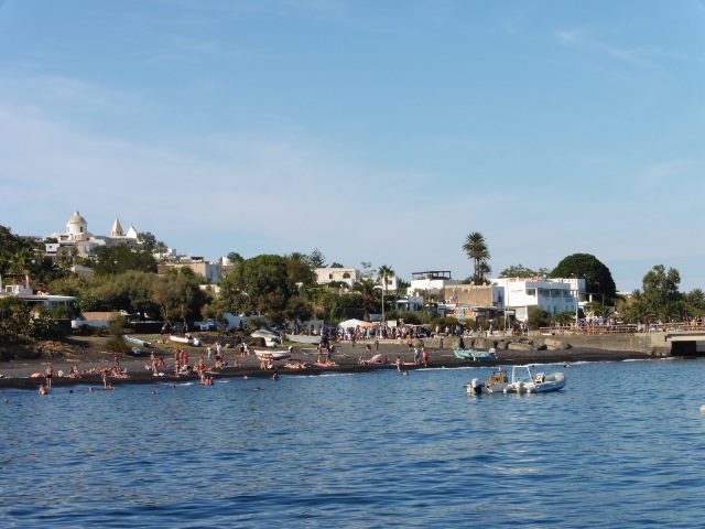
We were moored about 2/3 of the way down the Via Massimo Troisi &
 |
| Santa Marina from our mooring |
 |
| The green of Salina |
 |
| I think that's the shadow of Lipari in the background. I should make better notes! |
 |
| Panarea dead ahead |
 |
| Stromboli with no smoke plume & Panarea |
 |
| Err? Lipari to aft? |
My notes say I took pics of Panarea, Lipari & Salina from the same spot, & that the sea was very still when we cast off & headed north east at 0925.
 |
| Stromboli ahead ~ well zoomed! |
We motored past the east side of Panarea & towards some small islands & rocks to the east of the island.
We were to have lunch somewhere in the area & swim off the boat to see the fumaroles bubbling away in the sea.
We were also to have a trip to a sea cave in the zodiac.
 |
| Our lunch destination |
We arrived at the rocks just before 11 & most of us got ready to go in for a swim.
 |
| Small islets east & north east of Panarea |
 |
| There is an undersea fumarole near where that boat is |
website:
Geohazards associated to submarine hydrothermal systems still represent a tricky enigma to face and solve for the scientific community. The poor knowledge of a submarine environment, the rare and scarce monitoring activities, and the expensive and
 |
| There are also a lot of smaller rocks awaiting the unwary sailor |
In November 3, 2002, an explosion occurred 2.5 nautical miles off Panarea island, inducing an intense and long-lasting gas eruption over a shallow depth (2 to 30 m deep) and 2.3 km2 wide area surrounded by the islets of Panarelli, Lisca Bianca, Bottaro, Lisca Nera, and Dattilo. The “degassing crisis” lasted several months and killed all the living matter in the submarine area.
I also got a couple of diagrams & a photo from Hindawi:


 |
| Hydrothermal fluids emitted from submarine vents at the main hydrothermal field (Bottaro location, 8 m.b.s.l., 2017). |
|
| There are also a lot of smaller rocks awaiting the unwary sailor |
Eeek! :-0
 |
| According to Wiki Images, this one looks like it's Le Guglie. But don't quote me! |
 |
| Rock formations on Bottaro: Lisca Bianca to left |
We were all totally unaware of the above info that day, & I got some nice pics as we got closer :-)
 |
| The view from our anchorage |
 |
| Wiki suggests this is Isola di Lisca Bianca |
 |
| You wouldn't want to run aground on these . . . |
 |
| or these! |
Then Pepe picked his anchorage spot & most of us went overboard.
Snorkles were available, but I was used to holding my breath when going for a look underwater, so managed without.
Obviously, I have no pics for posterity, but I remember the smell, the weird feeling of the bubbles when I swam over the top & through them as they rose to the surface, & Pepe's warning about not swallowing any seawater hehehe ;-p
We had about an hour free before our jolly to the sea cave in the zodiac & then lunch, so after I'd swum about a bit (the sea was still Really calm), I decided to go ashore.
I found a suitable climbing out spot (ie somewhere without too much sharp lava to save my knees & shins from being cut to ribbons!) & wandered about for a bit.
As at Venus' pool a few days before, it was a bit tricky underfoot, so I binned the idea of a longer walkabout & sat on a less sharp & knobbly rock &
sunbathed for a few minutes before diving back in & swimming to the Pallas.
 |
| We were not the only ones interested in a closer look |
The pic on the right -->
shows the rocks where I'd climbed ashore.
shows the rocks where I'd climbed ashore.
Once we were all back
aboard, we were off again
 |
| Some other visitors get a closer look at a sea cave |
almost straight away when Rahul took us all for a brief jaunt to a sea cave.
Sadly, there are no pics of our trip beneath
Sadly, there are no pics of our trip beneath
 |
| Part 1 of my lunch & Serge looking pensive |
the island ~ the Lumix was charging while the generator was on.
Then it was time for lunch.
I was glad.
I was pretty hungry after all that underwater swimming!
 |
| Part 2 ;q |
Lunch came in 2 parts, & looking at part 2 reminds me a littlle of the 'vomit on a plate' I had when in the Hamilton Botanical Gardens in 2011 ;-p (see blog).
Hehehe
But, just as that seafood pate had, it tasted much better than it looked :-q
Lunch done, we upped-anchor & set off towards Stromboli.
 |
| Another gulet brings its passengers |
Lunch done, we upped-anchor & set off towards Stromboli.
Here's some Wiki info:
Stromboli is a small island in the Tyrrhenian
 |
| Rock & lava columns on Bottaro (or Lisca Bianca?) |
Sea off the north coast of Sicily, containing
Mount Stromboli, one of the three active
volcanoes in Italy. It is one of the eight Aeolian Islands, a
 |
| After Salina, Stromboli looks very barren |
volcanic arc north of Sicily.
Strabo writes that people believed that this is where Aeolus
lived.
Its name is derived from the Ancient Greek name
Strabo writes that people believed that this is where Aeolus
lived.
Its name is derived from the Ancient Greek name
 |
| Aline takes a photo & Philippe looks miserable. So what's new? ;-) |
The volcano has erupted many times and is constantly active with minor eruptions, often visible from many points on the island and from the surrounding sea, giving rise to the island's nickname "Lighthouse of the Mediterranean".
 |
| The 1st close up of Stromboli |
 |
| There were some green bits here |
 |
| The heaving pier at San Vincenzo on Stromboli |
A significant geological feature of the volcano is the Sciara del Fuoco ("stream of fire"), a big horseshoe-shaped depression created in the last 13,000 years by several collapses on the northwestern side of the cone.
Approximately 2 km (1.2 mi) to the northeast lies Strombolicchio, the volcanic plug remnant of the original volcano. Mount Stromboli has been in almost continuous eruption for the past 2,000 years (some volcanologists argue 5,000 years).
 |
| San Vincenzo's skyline. No tower blocks in sight ;-p |
 |
| Francoise & Philippe |
bombs, at intervals ranging from minutes to hours. The pattern is also observed at other volcanoes worldwide. Eruptions from the summit craters typically result in a few short, mild, but energetic bursts, ranging up to a few hundred meters in height, containing ash, incandescent lava fragments and stone blocks.
 |
| We set off along the Via Roma |
 |
| A narrow street in San Vincenzo |
continued for several hundred meters before collapsing. The resulting ash column reached a height of 2km.
So, now you know (& so do I ;-p )
We arrived at San Vincenzo port at about 1630 & were ferried ashore in the zodiac.
Most of us then had a brief wander round the little town of San Vincenzo, but Jenny & Elizabeth had opted for
the walk up to the crater, so they went off with a guide.
We arrived at San Vincenzo port at about 1630 & were ferried ashore in the zodiac.
Most of us then had a brief wander round the little town of San Vincenzo, but Jenny & Elizabeth had opted for
 |
| Ditto with flowers |
After about 1/2 an hour the rest of us set off walking with Nic in charge.
We were to walk to the Observatory near the Sciara del Fuoco ~ see above/below, which, according to Gmaps, was about 3.5K from the port, but - due to Philippe, it took us a while to get there.
 |
Chiesa di San Vincenzo Ferreri |
As usual, I walked more quickly than the rest, so had time to detour into the Chiesa
di San Vincenzo Ferreri for a few pics, & take photos of some of the other San Vincenzo sights.
Inside the church there were some lovely stained glass windows & a cool door, but the rest was fairly normal ~ for a catholic church, anyway.
 |
Inside the Chiesa di San Vincenzo Ferreri |
Inside the church there were some lovely stained glass windows & a cool door, but the rest was fairly normal ~ for a catholic church, anyway.
 |
| Nice stained glass - 1 |
 |
| Nice stained glass - 2 |
 |
| Clever stained glass door |
 |
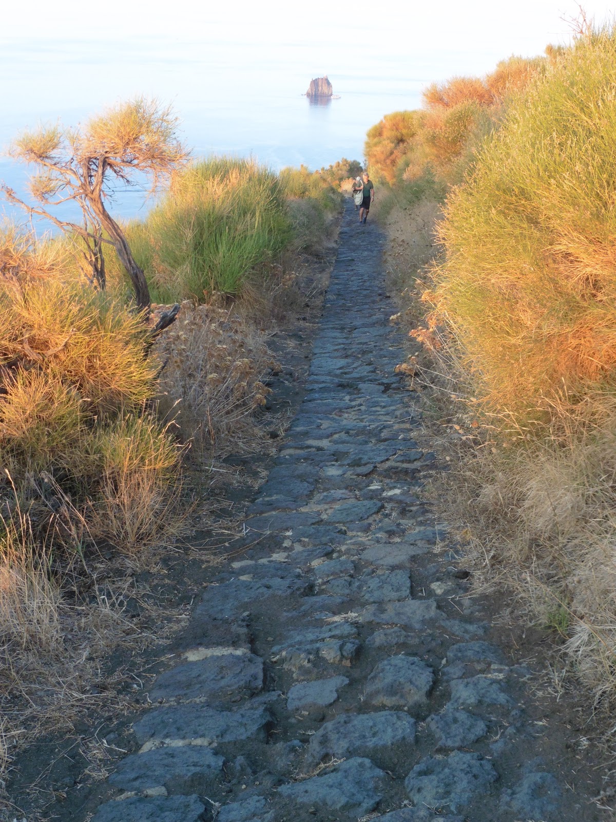
| Strombolicchio & its little lighthouse |
After a bit, the Via Roma turned into the Via Vittorio Emanuele which headed west-ish, & we gradually began to climb out of town.
That enabled us to see the Strombolicchio lighthouse which was on the volcanic plug in the sea to the NE of San Vincenzo.
 |
| It's a cat - of course I took a photo ;-) |
At this point I was still sauntering along with everyone else - more or less, but Phillipe was very slow, & I was chomping at the bit to get a move on.
We passed another
 |
| Possibly inside San Bartolomeo? |
According to Google Translate, mulattiera means muletrack, & this track meandered back & forth gently ascending the volcano's northern slope as far as the cafe called the Osservatorio.
 |
| Flowers in the dusk |
The sun was quite in the west by this time ~ after 6pm, & it was gloaming in town on the eastern side of the island.
 |
| Strombolicchio & the Punta Restuccia |
I was still hanging around for the others (AKA Philippe!), so grabbed a few ambient pics nearly every time I stopped to wait.
After a bit, I decided I needed the loo, so arranged with Nic that I would walk on to the Osservatorio cafe & join them at the observatory next to the Sciara del Fuoco.
Nic said the path off to the observatory was signposted.
So off I went for a Rule 10, & got an ice-cream while I was at it (but not exactly at the same time ;-p)
I didn't write what sort, but it probably involved chocolate ;-q
When I came out, there was no sign of the group, so I followed the path up the hill.
The Salita del Vulcano-Labronzo climbed up the northern slope on in a series of zigzags, but despite looking for it, I didn't see a sign for the observatory.
So I kept climbing.
For well over half an hour!
However, I wasn't walking uphill all that time because I kept stopping for
 |
| Bamboo & the volcano |
 |
| Cool path made of lava through the bamboo |
 |
| Pathside gekko (or similar??) |
After a bit, I decided I needed the loo, so arranged with Nic that I would walk on to the Osservatorio cafe & join them at the observatory next to the Sciara del Fuoco.
Nic said the path off to the observatory was signposted.
So off I went for a Rule 10, & got an ice-cream while I was at it (but not exactly at the same time ;-p)
I didn't write what sort, but it probably involved chocolate ;-q
When I came out, there was no sign of the group, so I followed the path up the hill.
The Salita del Vulcano-Labronzo climbed up the northern slope on in a series of zigzags, but despite looking for it, I didn't see a sign for the observatory.
So I kept climbing.
For well over half an hour!
 |
| No ships in sight yet. That's the Osservatorio cafe below |
However, I wasn't walking uphill all that time because I kept stopping for
 |
| The Sciara del Fuoco in the setting sun |
photos & to look at the views out to sea & up to the crater.
I also stopped periodically for shots of the Sciara del Fuoco in the lowering
 |
| Ditto as it meets the sea on the NW coastline |
sun, but eventually ~ deciding that I surely would have overtaken them by now & thinking ~ "there's no way they'd have
 |
| The Sciara del Fuoco has burned all the bushes away |
 |
| Looking north from the summit path ~ Salita del Vulcano-Labronzo |
 |
| Colours alongside the path down the Salita del Vulcano-Labronzo. Strombolicchio in the background |
So, after a final photo to show where I'd been, I set off back down.
 |
| Tyrrhenian sunset from Stromboli 1 |
While I was walking back down the Salita del Vulcano-Labronzo, I got a call from a worried Nic.
He told me off for getting lost (I wasn't lost: I knew exactly where I was ;-p ), & he described where the path off to the observatory was.
The Observatory path wasn't well marked at all & no wonder I missed it on the way up ~ it was very narrow, & looked like a goat track.
It is not even named on Gmaps
By the time I joined the others (who had eaten 'tea' sitting on the rocks or standing with cameras poised), it was 1915 & we all stood there for over an hour.
 |
| Tyrrhenian sunset from Stromboli 2 |
I got a couple of sunset shots while hoping to get a decent one of a flare from the crater.
Sadly, the eruptions were quite irregular & infrequent (only 2 in that time), so I didn't managed any, despite wearing out my clicking finger in the hope I'd be quick off the mark if one happened!
 |
| Smoke rises from the Sciara del Fuoco |
I recalled sailing past Stromboli in the dark on the Star Clipper in 2006, & standing on the volcano's northern slope on this occasion, I noticed the sea to the north of the Sciara del Fuoco slowly filling with various craft hoping to provide a light-show for their guests.
 |
| Smoke rises from the central crater |
After a fruitless photo-lurk ~ certainly for me :-( , Nic said we would walk back down
 |
| My attempt at catching a spurt of fire at the Observatory |
 |
| By this time the moon was up again in the east |
Setting off at 2045 we detoured to the Osservatorio loos & I got a pic of the moon to the east & a pic of a crater flare to the south when I came out & waited for the others.
.
 |
| A better attempt at catching a spurt of fire from the crater, but still not great :-( Maybe next time? |
We went a different way down to town, lit by our torches. Most of which were the 'wind-up' version, so I have a memory
 |
| Last pic of the day from the Via Marina |
of clockwork winding noises behind me in the dark!
We had sea to our left for a lot of the way, & Gmaps suggests that we walked along the Via Regina Elena then the Via Marina.
We reached the shops (& streetlights ;-p) on the outskirts by 2130 & the pier 1/2 an hour later, whereupon Nic telephoned the Pallas & Rahul came to collect us.
By 1030 we were all back aboard except Elizabeth & Jen.
They arrived at 11ish & said they hadn't been very impressed with the crowds walking up to the crater, & the speed of the hike.
I put the Lumix on charge while the generator was on, checked Es on the Sanyo, then Pepe upped anchor at 1115 & we were on our way north & west around the island on our way to Panarea.
I remember the sea had stopped being calm by this time & that it was a great rocky ride in bed in the dark to our next island :-))
OAO
No comments:
Post a Comment