Day 7 ~ Nov 26th: Waitiki Landing to Waitangi via Te Hapua & Kerikeri
 |
| Early morning shadow at the Te Hapua turn |


There obviously wasn't much traffic, as there were about 30 horses & foals meandering about on the grass either side of the 'promenade'.

All the houses were one storey, including the church & school.
The road ended by a small jetty, but I had to wait for a dog to get up off the road to get there.
He went straight back once I'd passed :-)

Parking the car near the jetty, I walked a little way into the bush for a Rule 10 ~ there were no public loos here!
Coming back to the car I heard a racket coming from a tree & saw 2 white-faced herons sitting up there.
It was spring down there, so maybe they had a nest & were warning me off?
 |
| The 2 white-faced herons (Egretta novaehollandiae) in a pine tree at Te Hapua |

The tide was far out enough for me to want a paddle ~ it had been in the day before, so as it was a bit rocky & I was wearing flip-flops (to keep my feet cool!), in I went.
 |
| As it says on the sign, the school is the most northerly in NZ |

It was an exceedingly rural spot, & would have been a long way from the nearest supermarket ~ at least an hour each way to the small one in Houhora, & an hour and a half to the big one in Awanui.
 |
| The dog was back in the road |

 |
| Dog Island with white sand dunes behind |
It called Dog Island & the trees on it give it the look of a turret. It looked like there was snow on the hills, but I've learned that it's the very white silica sand the harbour is known for ~ see previous blog.
 |
| The dog lays back down |
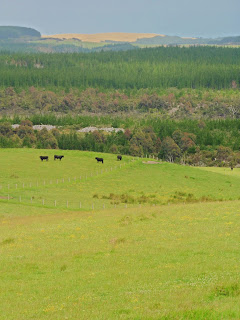 |
| Cows, bush & big dunes against the sky |
Once past Te Kao, as the road wound through the farmlands & bush, I got occasional glimpses of the silver and gold dunes to the east. They looked amazing, & I would've liked a closer look, but I had to get south for my day-long ride to an extinct volcano the next day.
Reversing the route from Monday morning, I took a left at Awanui onto the SH10, eventually coming to a sign for a winery on the Karikari peninsular.
It was 1245 & I was ready for some lunch, so I went left onto Inland Rd which went more or less due north for a bit before turning right towards the Carrington Winery on the Karikari Estate. Apparently, it's the most northerly winery in NZ.
It was a glorious spot, & my table had a view of Rangaunu Bay.
Had I been high enough, I would have seen Doubtless Bay behind me.
 |
| Great Exhibition Bay was to the far north with Henderson Bay south of it, but the sea I could see was Rangaunu Bay & Karikari Moana |
I had an Hawaiian washed down with a glass of Toa. Apparently that means Warrior in Maori, & it certainly packed a lovely punch.
Yummy :-q
It was very windy, though, & as I'd put my wine glass on my map, the wind blew it over. Fortunately, I'd drunk most of it by then!
 |
| Stone-baked pizza & an Estate Toa |
 |
| My table was in front of the arch on the left |
Setting off again, I turned south at the SH10 junction & didn't stop again until I got back to Paihia, where I decided to detour over the bridge to the Waitangi Treaty Grounds before going back to Peppertree Lodge.
Arriving at Waitangi at 1510, I spent nearly 2 hours wandering about the paths through the bush & gardens, saw the famous Waka, & had a look into the Treaty House & the Marae near the flagpole.
If you google Treaty of Waitangi, you can find out why the place is so significant, but I pinched some info from the Waitangi National Trust website.
 |
| Not sure what this tree stump is? Possibly a kauri? |

 |
| Ngatokimatawhaorua is on the left |
The website says this about the Waka & their house:
The waka house near Te Ana o Maikuku shelters the iwi Ngāpuhi’s ceremonial war canoe Ngātokimatawhaorua, the world’s largest. The 35-metre-long canoe needs a minimum of 76 paddlers to handle it safely on the water. It weighs 6 tonnes when dry and 12 tonnes when saturated.
The waka was built as part of Ngāpuhi’s contribution to mark the centenary of the Treaty of Waitangi’s signing. Work on the canoe began in 1937 and Ngātokimatawhaorua was launched in 1940. It was then laid up for 34 years in a canoe shelter alongside Te Whare Rūnanga.
In 1974, the waka was renovated for the Queen’s visit to Waitangi, and the shelter, Te Korowai o Maikuku, was built to house it near to shore. After the Queen’s voyage on Ngātokimatawhaorua, she designated it ‘Her Majesty’s Ship’, which makes the waka part of her Royal Navy.
The waka is launched every year on 6 February as part of Waitangi Day celebrations.


After the Waka, I went out to the Treaty House & the Marae.
I managed a few pics inside the Marae, but there was a great one on the website, so I borrowed that as well.
 |
| A chair inside Te Whare Rūnanga (the House of Assembly) |
 |
| A beautiful screen inside Te Whare Rūnanga |
 |
| Looking down the length of the building |
 |
| Te Whare Rūnanga from the outside. Shame about the bollards! |

Te Whare Rūnanga is a carved meeting house in traditional form but is a unique expression of its purpose. It stands facing the Treaty House, the two buildings together symbolising the partnership agreed between Māori and the British Crown, on which today’s Aotearoa New Zealand is founded.
The concept was proposed by Māori Member of Parliament for the north, Tau Henare, and Sir Apirana Ngata, then Minister of Maori Affairs, as a Māori contribution to the centenary celebrations. Carving began at Tau Henare’s home community of Motatau in 1934, and the house was opened on 6 February 1940 – 100 years after the first signing of the Treaty of Waitangi.
Meeting houses are symbols of tribal prestige and many embody a tribal ancestor. The head at the roof apex is the ancestor’s head, the ridgepole the backbone, the bargeboards the arms with the lower ends divided to represent fingers. Inside the rafters represent ribs, and the interior is the ancestor’s chest and belly.
Te Whare Rūnanga follows this form, but is not identified with any tribal ancestor. Rather, it represents the unity of Māori throughout Aotearoa New Zealand. This is emphasised by the main carving styles of iwi across the land being brought together – creating a remarkable gallery of Māori art, as well as a spectacular example of a central part of Māori social and cultural life.
 |
| A great tree standing between the 2 buildings |
 |
| A view to the flagpole from inside the "Treaty House" |
The flagstaff marks the spot where the Treaty of Waitangi was first signed on 6 February 1840. The current flagstaff replaced the one that had been erected for the first Waitangi Commemorations held 6 February 1934. The Royal New Zealand Navy erected and rigged out the flagstaff in time for the February 1947 ceremonies. The Royal NZ Navy continues to maintain it annually.
The three flags flying are New Zealand’s first Flag adopted by the United Tribes of New Zealand at Waitangi in 1834, flying side by side with Britain’s Union Flag, and the New Zealand Ensign, adopted in 1902, flying at the top of the flagstaff.

This is also off the net, & is James Bush's house at Waitangi, known as the Treaty House. The tree shadow on the right is that of the one in the pic above.
My Waitangi wanders & wonders over, after checking out the turning at Hararu Falls, I drove back along the promenade at Paihia, having driven another 285K.
Someone had the Depp 'Sweeney Todd' on in the lounge, so I watched a bit of that with tea.
As I had another fairly early start, & about 6 hours on a horse the next day, I went to bed without checking Es.
Day 8 ~ Nov 27th: The Volcano Ride

I wanted to check out the falls, so I left Peppertree at 0745 ~ in plenty of time to get to my ride at 0900.

The falls were quite pretty, & as it was still only about 0815, the sun hadn't yet leached the blue from the sky.
It was an awesome colour.

Continuing up Haruru Falls Rd. to the stables on Wakelins Rd., I found I was way too early, so left again & carried on up Haruru Falls Rd to a barrier where several tracks went into the bush.
 |
| Early morning picture of the bush & the Bay of Islands |
 |
| This looks more northerly, & actually towards where we would ride that day, but I didn't know that at the time. |
As we were due to be swimming the horses, I changed into my bikini under the jodhs, had a good spray of bug repellent, & set off with a Swedish girl leading the way. I didn't catch her name either. I'm slipping!
We followed the road up the hill I'd driven up earlier, but we were able to get the horses past the barrier & took a curving path around the hill to the twin volcano craters.
 |
| Looking down into 1 of the craters |

I rode my horse, Sheekan, up the hill a bit to try & get a better pic of the crater, but with all the vegetation, it wasn't very clear where it was.

The crater to the east gave a better impression of a hole, helped by the perspective of horses ears!
 |
| This was another unsuccessful attempt :-/ but you can see how lush the bush is |
 |
| Standing in front of the 2nd crater looking towards our lunch destination at Wairoa Bay |
If you Google Lookout Rd., & view the terrain (not the map), they can be clearly seen in the aerial view.
 |
| Horse, crater, bush! |


While we were there, some local horses came for a nosey.
 |
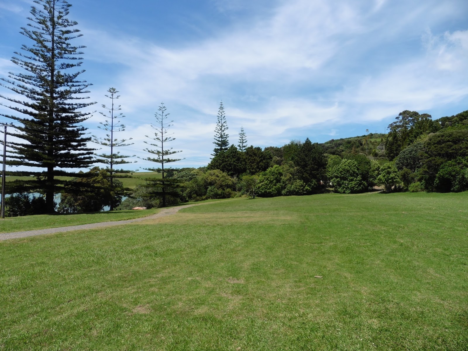
| Norfolk pines beside a seaside meadow |
 |
| A Pohutakawa tree |
It was a lovely peaceful spot.

The horses had halters on underneath their bridles, so we tacked-off, & tied them up under a Pohutakawa.
I handed over the camera for my attempt at swimming a horse, but Sheekan wasn't at all keen, and did a lot of splashing with her foreleg rather than walk deeper.
We got deep enough that I was nearly sitting in the sea, but not so deep we started to float.
Shame.
I hadn't swum a horse since 1980 in Kezar Falls, Maine, when I spent a summer as a Summer Camp Counsellor at Camp Hiawatha.


While Sheeka dried off, the other 2 went in.
He was even less keen, & the poor lass fell off.
She let go of the lead-rope as well, but he didn't make a mega-bid for freedom, & just stood on the beach.
I caught him for her, & she had another go.
 |
| We weren't the only riders out for a picnic by the sea |

I think she decided that discretion was the better part of valour, & led him in the 2nd time.
He seemed to like it better that way, & went quite deep.
 |
| Just beyond the trees is the Waitangi Treaty Ground |
It was a lovely picnic, complete with sun-block due to the hole in the ozone layer over NZ!, & all 4 of us were dry before it was time to head back home.
 |
| By the way ~ this isn't me! |
 |
| Lunch |

 |
| This is a bit blurred, but it was a nice shaded track off the road |
We went a slightly shorter route back, because we didn't need to go up to the craters.
Plus, we walked all the way.
Once back at the stables, we hosed all the seawater off the horses, & I said goodbye & thanks to Sheekan.
Then I got back in the car & filled-up the tank on my way into town.
I was driving back to Auckland next day, & going via Dargaville on the west side of Northland, so I wanted to be sure I had a full tank.
It was still quite early, so left the car at Peppertree & walked back along the prom for a sunbathe. I lay on the beach, & fell asleep for about 40 min.
Must've needed it?
All that fresh air & all that :-p
Back at Peppertree ~ after another trip to the shop for food (milk, 'dated' curry, & an ice cream), I found there were 8 new peeps in my bunk. One of them was Axel who was an Engineer from Mainz. He said he'd given up his job to travel.
How brave! Go Axel!
I had the curry with the last of the kumara, & shared a glass of Ake Ake Sauvignon Blanc with Axel.
Then I tried to get on-line, as Kev had E'd to ask how it was all going, but despite writing a long E in reply, it failed to send.
Bloody technology!
Eventually I gave up in disgust, & after managing to get a nice atmospheric sunset over Paihia, I went to bed, intending to try again at breakfast before I set off to see Tane Mahuta in Waipoua Forest.
OAO
 |
Sunset over Peppertree Lodge, Paihia
|
No comments:
Post a Comment